Housing Units Panorama, Brno, city planning
2008 – 2009
| Team: | Rastislav Balog, Jakub Kovářík, Šárka Macháčková, Petr Pelčák, Petr Uhrín |
| Investor: | Moravská stavební – INVEST, a.s., M.S. Panorama, s.r.o. |
| Traffic design: | Petr Soldán |
| Landscaping: | Antonín Wagner |
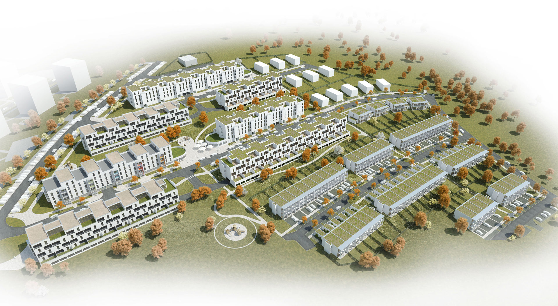
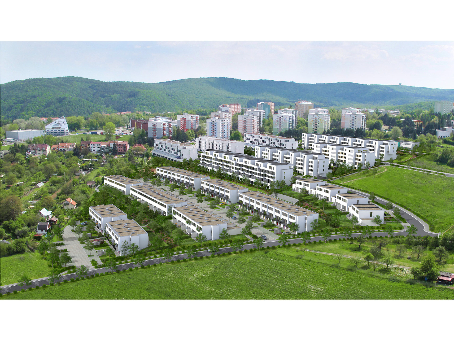
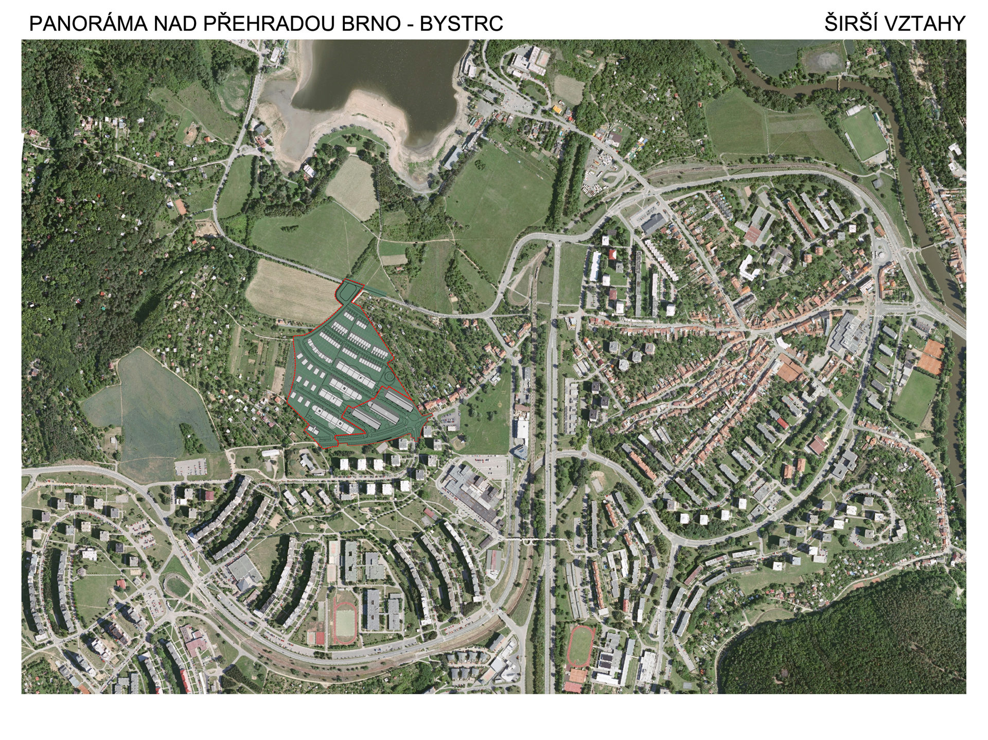
The land for the housing unit lies on the edge of the city and the suburban landscape and slopes to the north. There are lovely views from it of the Kníničky reservoir basin. The land-use plan was designated for a height and density of construction development with an index of floor space of 0.4 – 0.8.
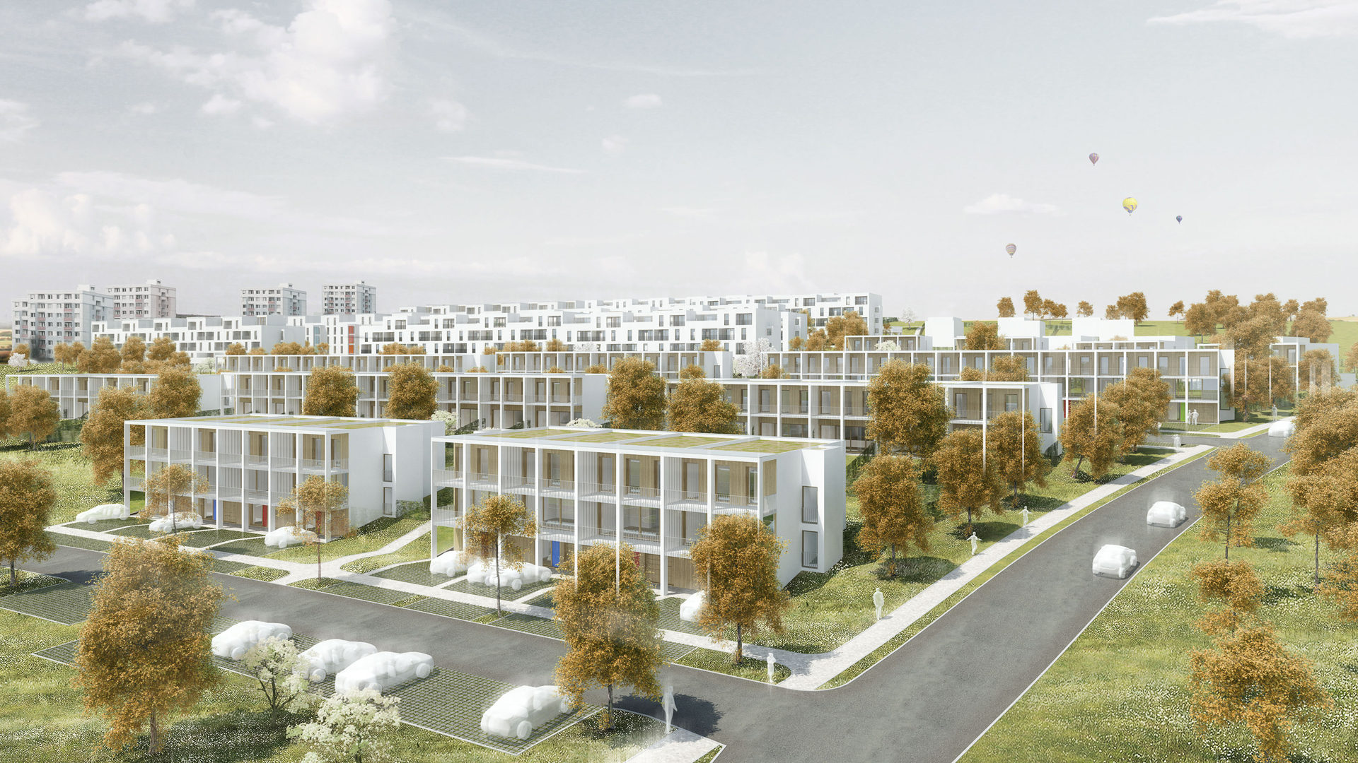
The aim of the design was to create a housing quarter. This was not to be merely an ornament involving a mechanical placement of housing structures, but a structured unit with a natural centre consisting of civic structures (a pub) and with the varied, while at the same time comprehensible and distinct, character of public spaces. The residential buildings and houses make up the fronts of four streets lined along in layers. The structure of the construction development progresses from the foot of the slope on the north-east along its ridge to the south-west with horizontal street fronts placed on the slope above one another. There are houses at the bottom, leading to flats all the way up to high blocks of flats from the 1980s at the top of the hill. The natural horizons of the dam, destroyed by the group of blocks of flats insensitively placed on the top of the hill, are therefore included into the construction development on the slope thereby minimizing their aggressiveness and arrogance.
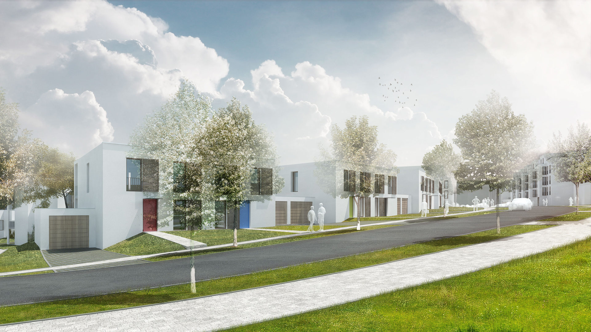
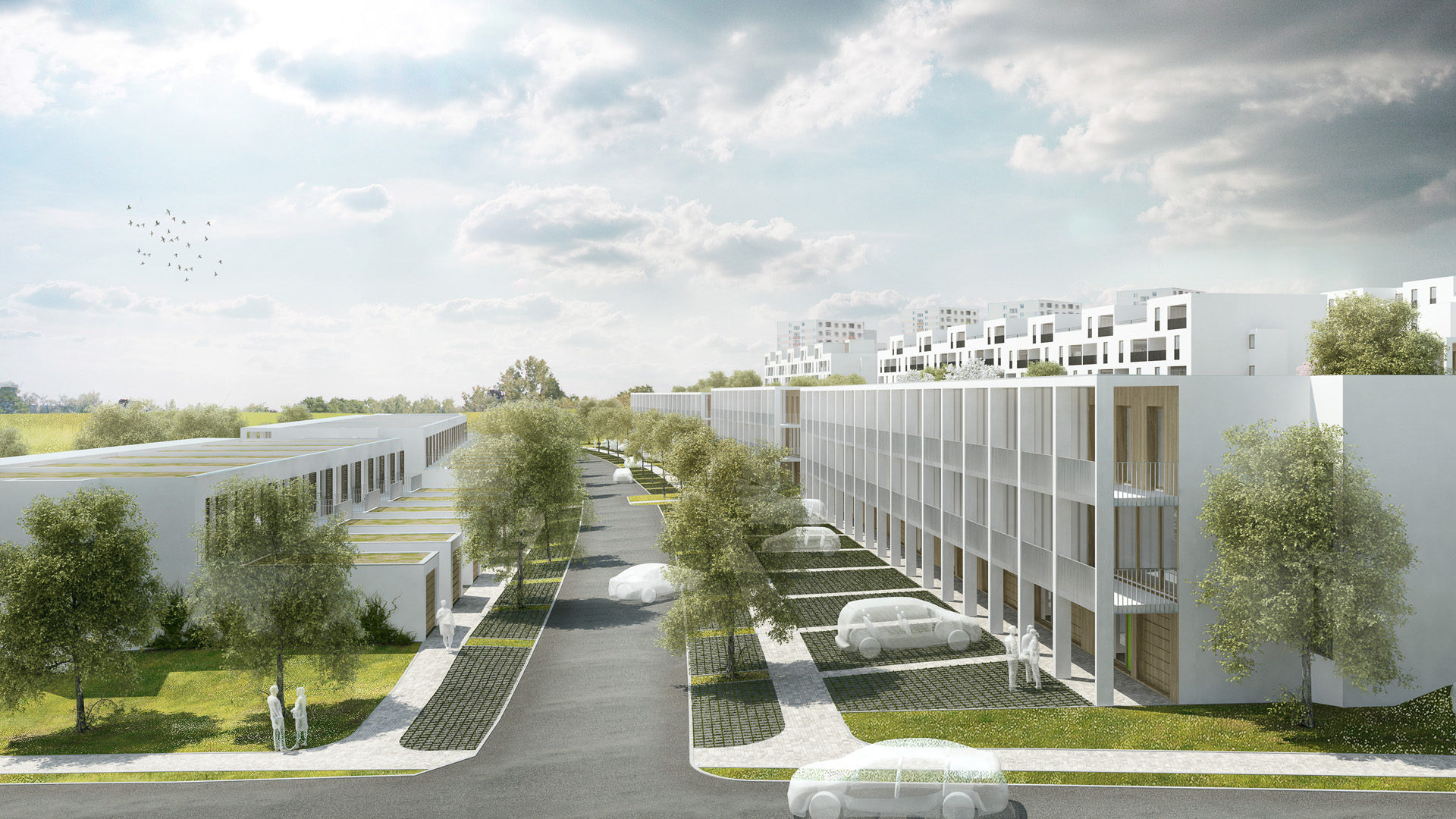
The entrance facades of the housing blocks are bayed with vertical stairway cores, therein creating a distinction between the particular houses in their street fronts. The “centre” consists of a small piazza with a symmetrical motif of a double half-cylindrical termination of the ground floor of the opposite housing blocks which contain the community facilities. The paths are designed with a view to a minimalizing of the firm surfaces preventing the soaking in of rain water and making up a curve rising or falling along the slope. A pavement leading along the fall line is the shortest footpath leading to the banks of the dam. It connects up the highest and lowest placed part of the housing collection, dividing into up into the part with housing blocks to the east and with houses to the west. These with their small scale serve to create a transition to the suburban landscape with cottage communities above the dam.
The quality of housing in this suburban locality is improved by the provision of outdoor housing surfaces in the majority of the flats, that is loggias, balconies and roof terraces which also emphasize the residential character of the construction development and give it a smaller scale. The denticule of the upper floor of the housing blocks and the marked projecting balcony boxes as well as the niches of the loggias distinctly articulate their volumes. The shade emphasizes the three-dimensional aspect and plasticity of the construction development on the slope. It therefore prevents “merging” of its appearance into monotonous volumes and emphasizes the morphology of the place.
The design of the unit was carried out in two stages (but not entirely according to the design – the developers were unable to purchase the north-east part of the land). It consisted of 354 flats and 150 houses, 354 flats and 61houses were built in the end.