Špitálka, Brno
2019, open competition, second prize
| Team: | Jakub Czapek, Petra Fialová, Karolína Langnerová, Filip Musálek, Petr Pelčák, David Vahala (project supervisor) |
| Commissioner: | Statutary City of Brno |
Concept
The city is the program. This means the determination of public spaces, their character and quality and that which defines the potential of the environment regarding habitation. The strategy is simple: to work with the urban typology and comprehensible types of urban spaces. We link fragments of the buildings formed in the past in order to create the whole of the city district, which we then connect to the surrounding city by the streets already existing on the borderline of the territory. The new and old is then unified by the scale of the urban structure. We articulate with an architectonical mindset all of the situations in order to create places which in turn create a city atmosphere. The design is particular and in certain aspects, it is an ideal image of a possible city, but it is flexible at the same time. Each designed solution and its form also offers its possible alternative and takes into account a gradual realization and any possibilities of creating a compact city, that will come during the time.
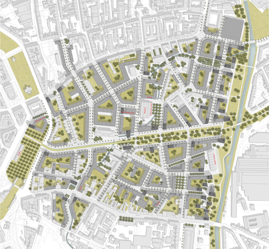
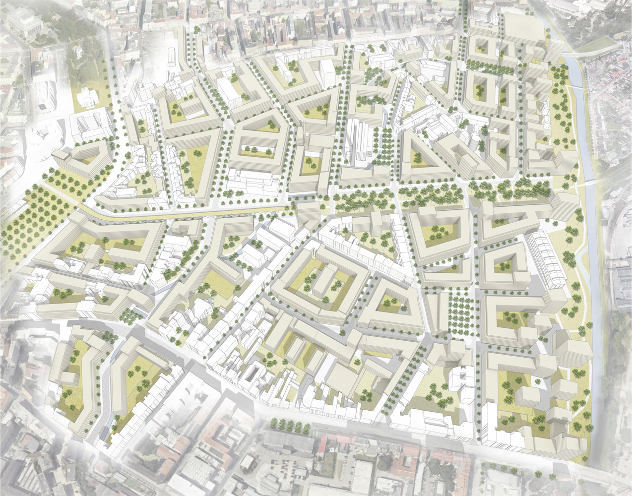
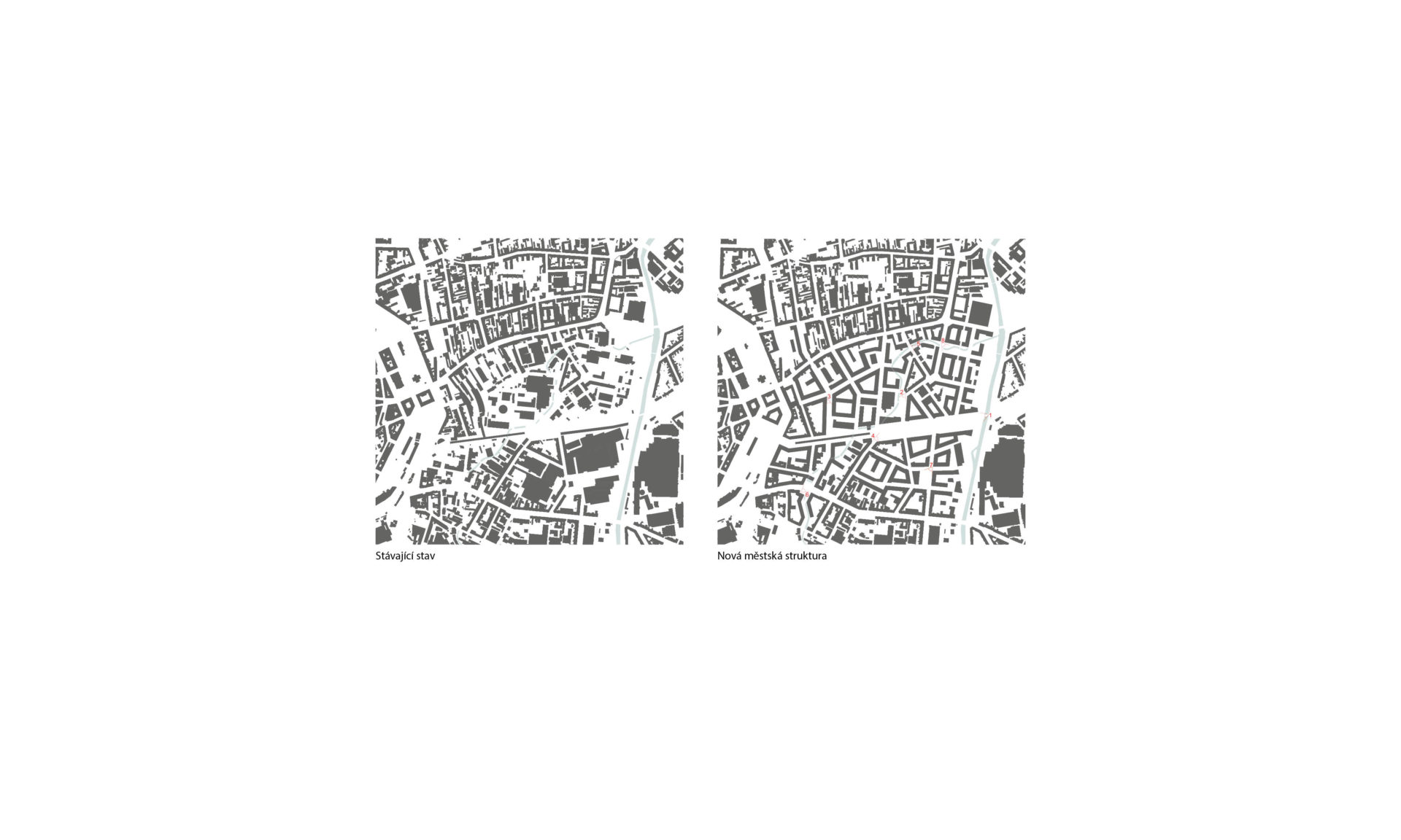
The urban texture of the territory
The urban structure of the new district for 25 thousand inhabitants is based on city blocks of the usual size but often of an irregular shape. This is because the street network is based on the existing, often unfinished streets, and is connecting the fragments of the urban area that are linking the street routing in the surroundings. The design of the interconnected city texture, by linking new streets to those existing on the borderline of the territory, is an important aspect of this design. It is also the connection of the old and the new housing areas. The scale and the size of the new street fronts are linked to those existing. Another principle is the structuring of the housing area according to the property map. That is, the location of streets or public spaces on the property borderlines so that the streets are creating a natural dividing space with no limitations to the possible development of the surfaces of the particular owners. The revitalization of historical industrial buildings is an another important element of the new parts of the city.
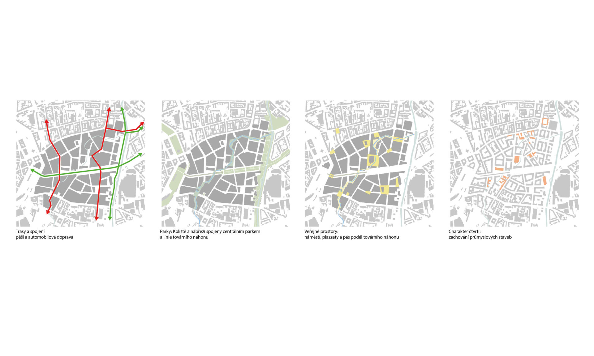
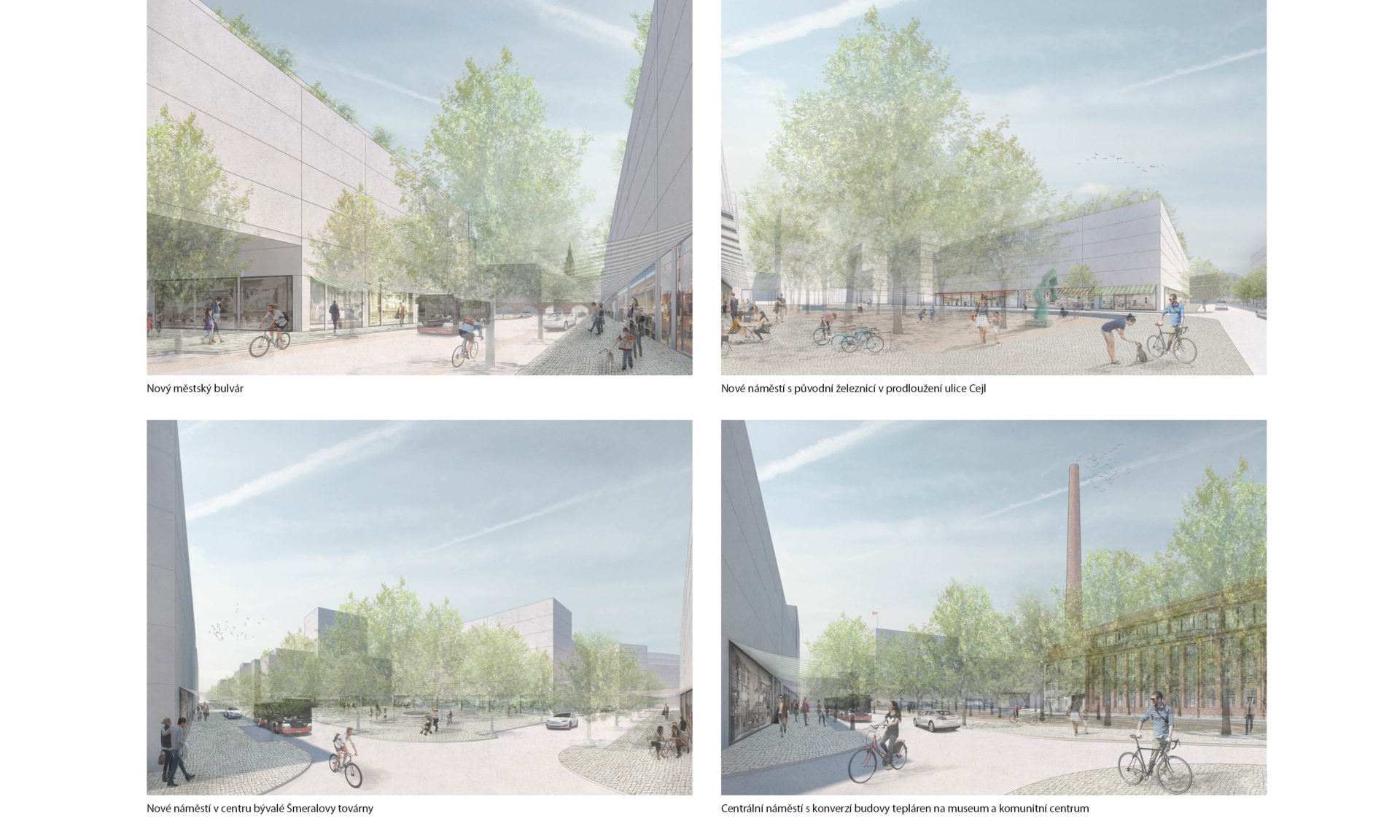
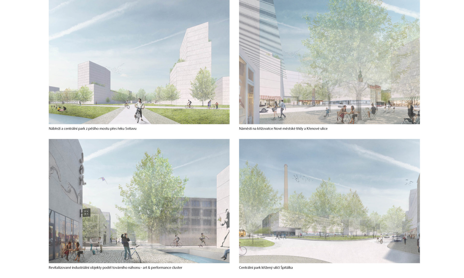
Urbanism and its determinants: the main square, the embankment, the central park, and the factory waterway
Public spaces, streets, squares, and a piazzette shape the urban structure of the district. The center of the district will be the central park on the site of today’s railway line as well as the central square, in the area of which is the historic building of the city heating plant. It is used as a museum of Brno industry or as a community and leisure centre. (After the construction of a modern heat source in the open area adjacent to the heating plant, its annexes will be removed and it will be returned to its original form from the year 1930). An extraordinary landscape feature of the area is the Svitava River, which the housing area is facing. The higher residential buildings stress the position of the river to make it more visible as a whole. Another unique element of the district is the factory waterways, which curve diagonally through it. The territory of its adjacent area provides a specific character. The pedestrian line along the waterways leading through the yards of former factories with newly used industrial objects creates an attractive “alternative” space of the city, offering the district its distinctive character.
New city boulevard and transportation route North-South
The boulevard is a busy city street with a commercial parterre providing previously lacking traffic service. The number of road lanes is reduced from the originally planned four to two because of the fact that a four-lane road could not be made without any brutal demolition of the historical building substance, but also because of the significant part of the traffic in the North-South direction which takes over the newly designed street and is better positioned for sharing the traffic load. It is routed in the line of Masná Street and the direct north part of Cejl Street which creates connections between Olomouc (Zvonařka) and Bratislava (Dornych) radial street patterns with Cejl Street in the south, respectively the connection of Nová Zbrojovka and Stará Osada (through a new bridge on the Šámalova Street axis), i.e. with the large city orbital road to the north. The public transportation is also led on this important route of the north-south interconnection of the city traffic.
Territory Opening
We can assume that the new area projects will be proposed by several participants in several locations. Firstly, from the public sources (new city boulevard and the abolition of the railway line) as well as by private investors (by developers of different brownfields). A necessary component for the successful realization of the territory revitalization and the construction of a new district in immediate proximity to the city centre is the urban management (the so-called urban project).