Territorial Study for Červený kopec, Brno
2017 – 2018
| Team: | Barbara Bartoňková, Jan Foltýnek, Martina Holá (project supervisor), Jan Kozák, Filip Musálek, Petr Pelčák, Miroslava Zadražilová |
| Commissioner: | Statutary City of Brno |
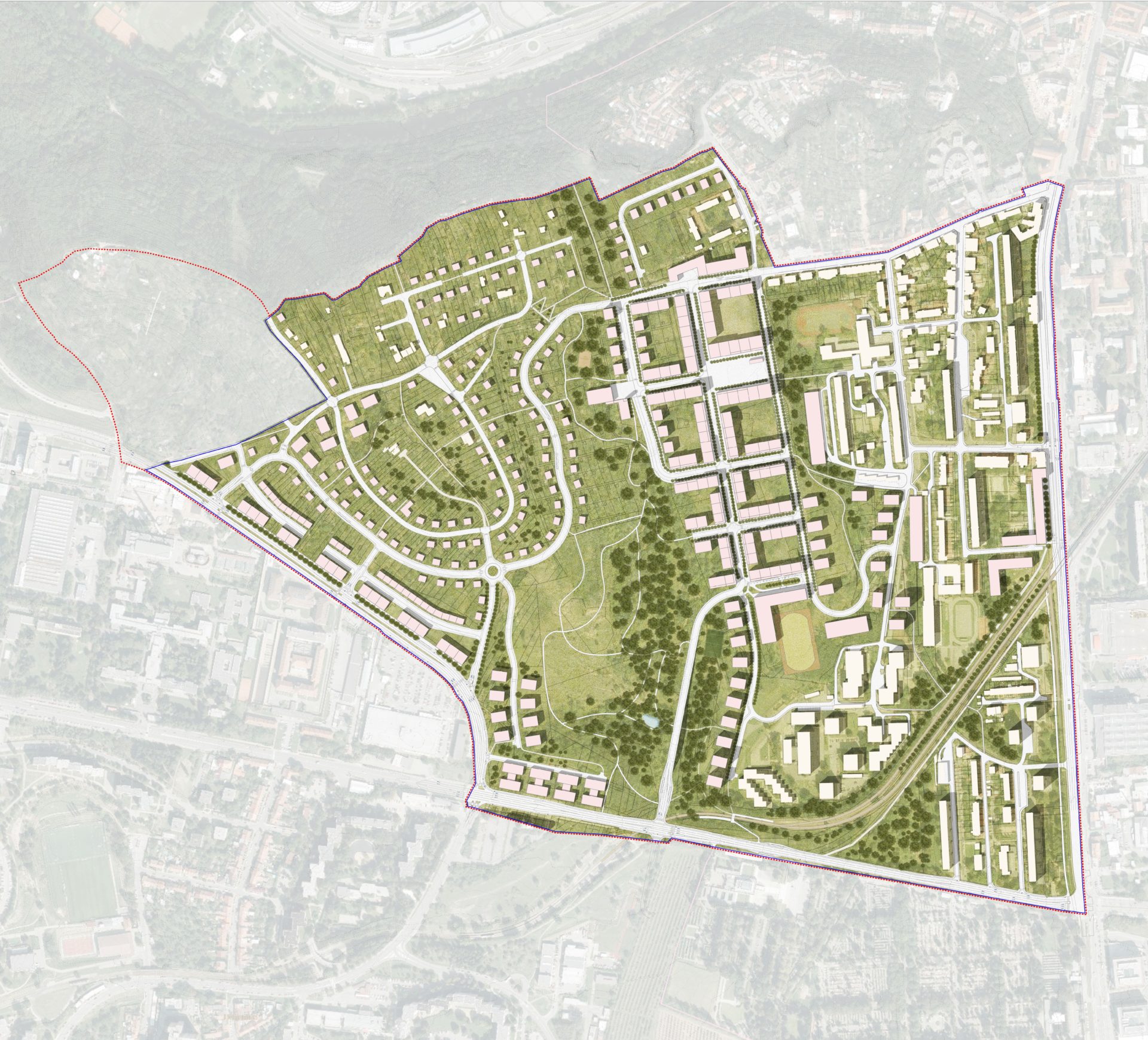
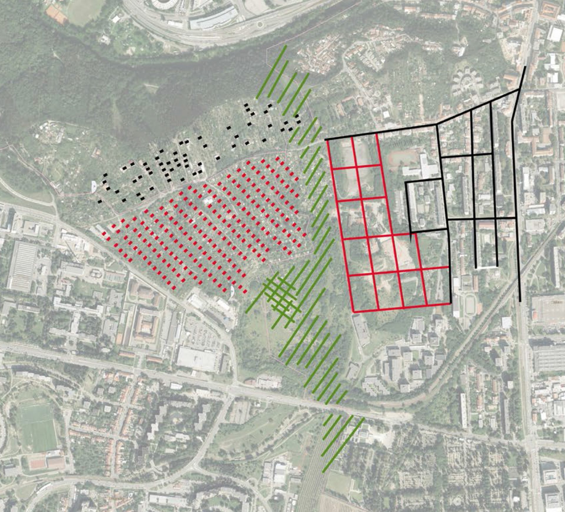
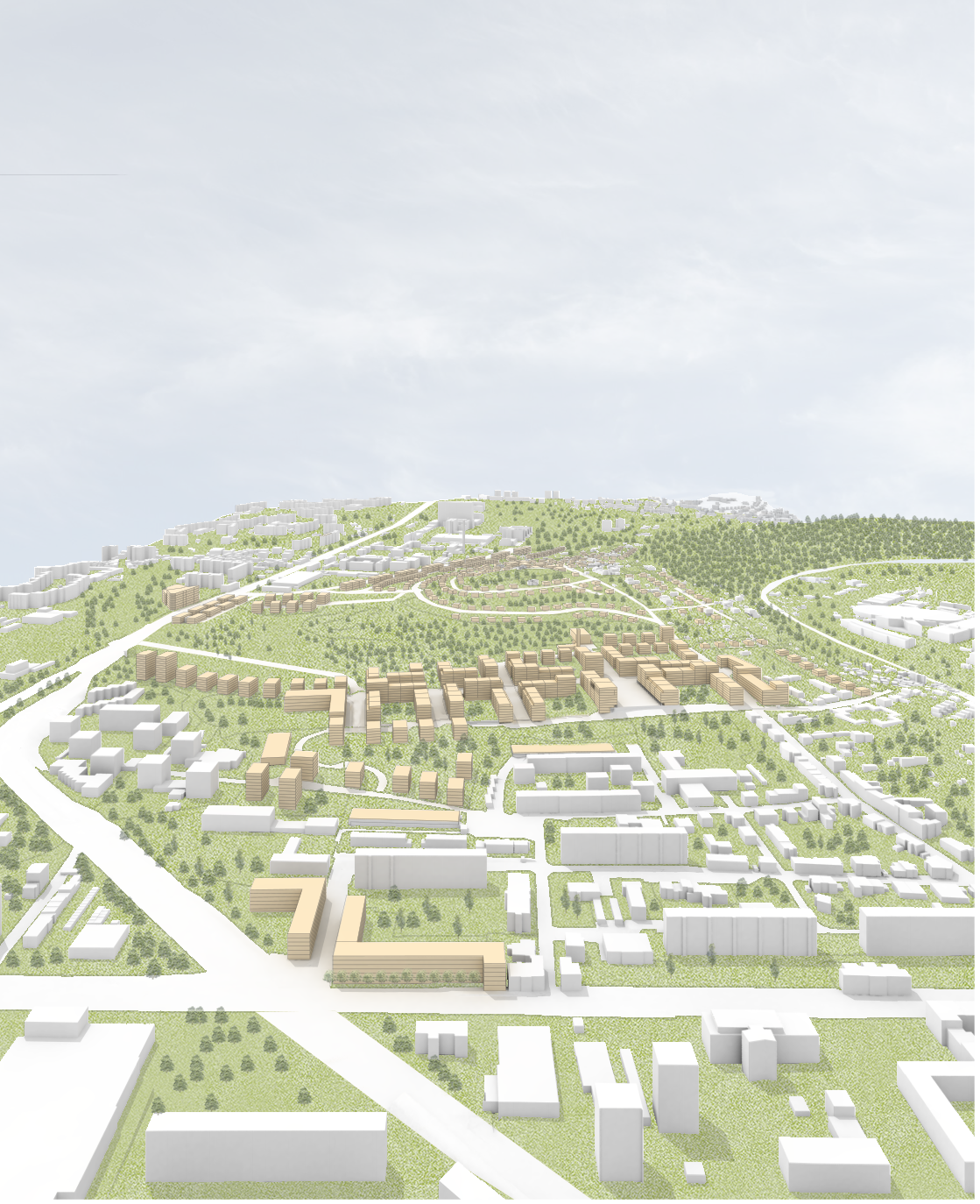
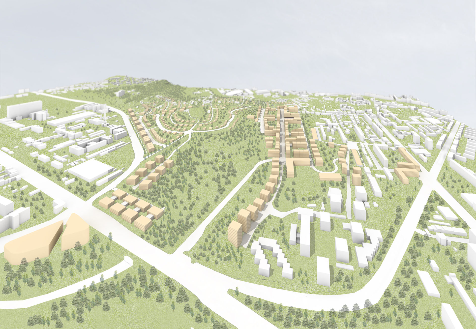
The study involves the design of the transport link of the territory which does not overload the radial road of Vídeňská street, but in contrast provides an immediate decline in transport load and a short connection to the large city circuit and the D1 motorway. The territory is now connected from the south, along the streets Kamenice and Jihlavská. The interruption of Vinohrady street serves to prevent the car traffic across Červený kopec. Its territory is designed to urbanize the two characteristics of the development: the garden neighborhood of residential homes on the slopes under the summit (“which remain natural”) and the structure of the city grids with blocks or fronts of rows of detached houses on the eastern, lower part on the terrain, formed by the activity of the brickworks on the city texture along Vídeňská street.A design for the transformation of the largest brownfield land in Brno of the former Kohn brickworks into a new urban neighborhood for 10,000 inhabitants. The locality is particularly suitable for urbanization as it is situated inside the city, at the circumference of its wider core, the sloping terrain of which provides lovely views and which neighbors Pisárek valley, a traditional recreational area of the city.
A wide belt of urban nature, which fulfills three important functions, is left between both urban features: linking up the vegetation of the slopes of Pisárek and the central cemetery, making up the continuous, natural horizon line for the area and at the same time a large park inside the new city area, this being part of the required regime of the national natural monument of the uncovered layers of the original monolith. The design creates a comprehensible residential environment with solid orientation, working with the traditional urbanistic typology of public spaces and public buildings. The centre of the new neighborhood is a large square on a terrain terrace which opens up onto an impressive view of the core of the city as well as its southern suburbs and the adjoining natural landscape. The development is designed so as to form a traditional city neighborhood, that is with a square with shops, a church or community centre in its axis, a school, a retirement home, parks and possibilities for placement of employment opportunities (administrative buildings, etc.). Good traffic service by means of the city transport service is an important aspect, involving not only a new tram station at the crematorium, but also city trolleybuses and buses.
In light of the fact that Červený kopec is divided in terms of ownership into several bodies, the realization of the area will depend on cooperation with all of the owners, which should, for the benefit of everyone, be carried out under the leadership of the city of Brno in the form of a so-called urban project, this being a format developed for similar situations in western Europe.