Alongside Piletický potok (Piletice creek), Hradec Králové
2020
in cooperation with Šindlar s.r.o.
| Team: | Miroslav Juren, Petr Pelčák, Jan Rolinc |
| Investor: | Statutární město Hradec Králové |
City district
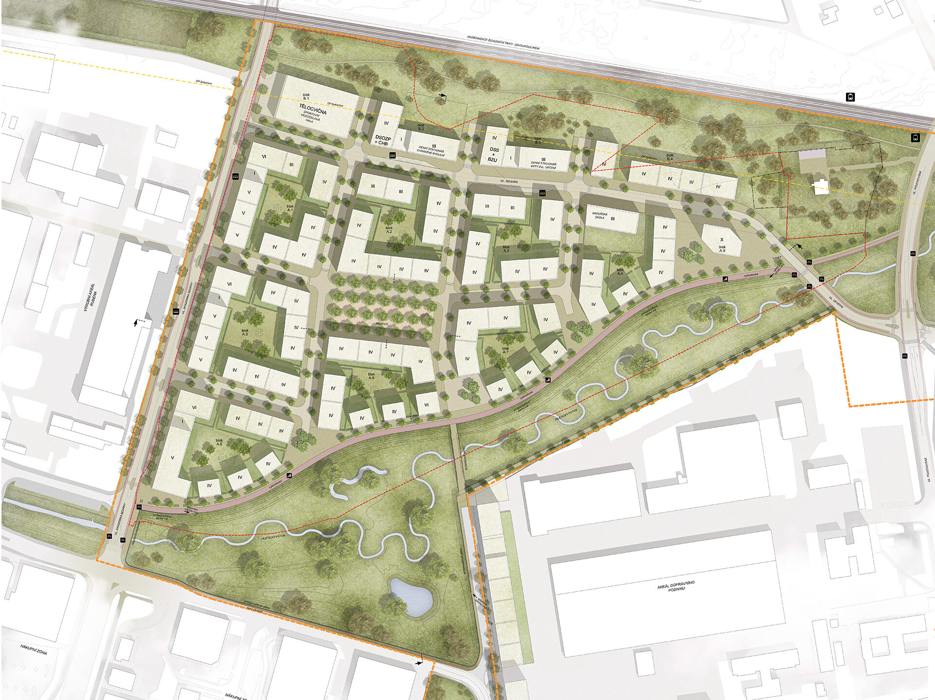
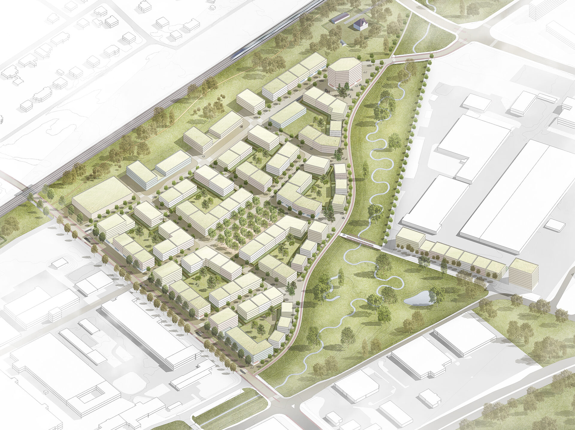
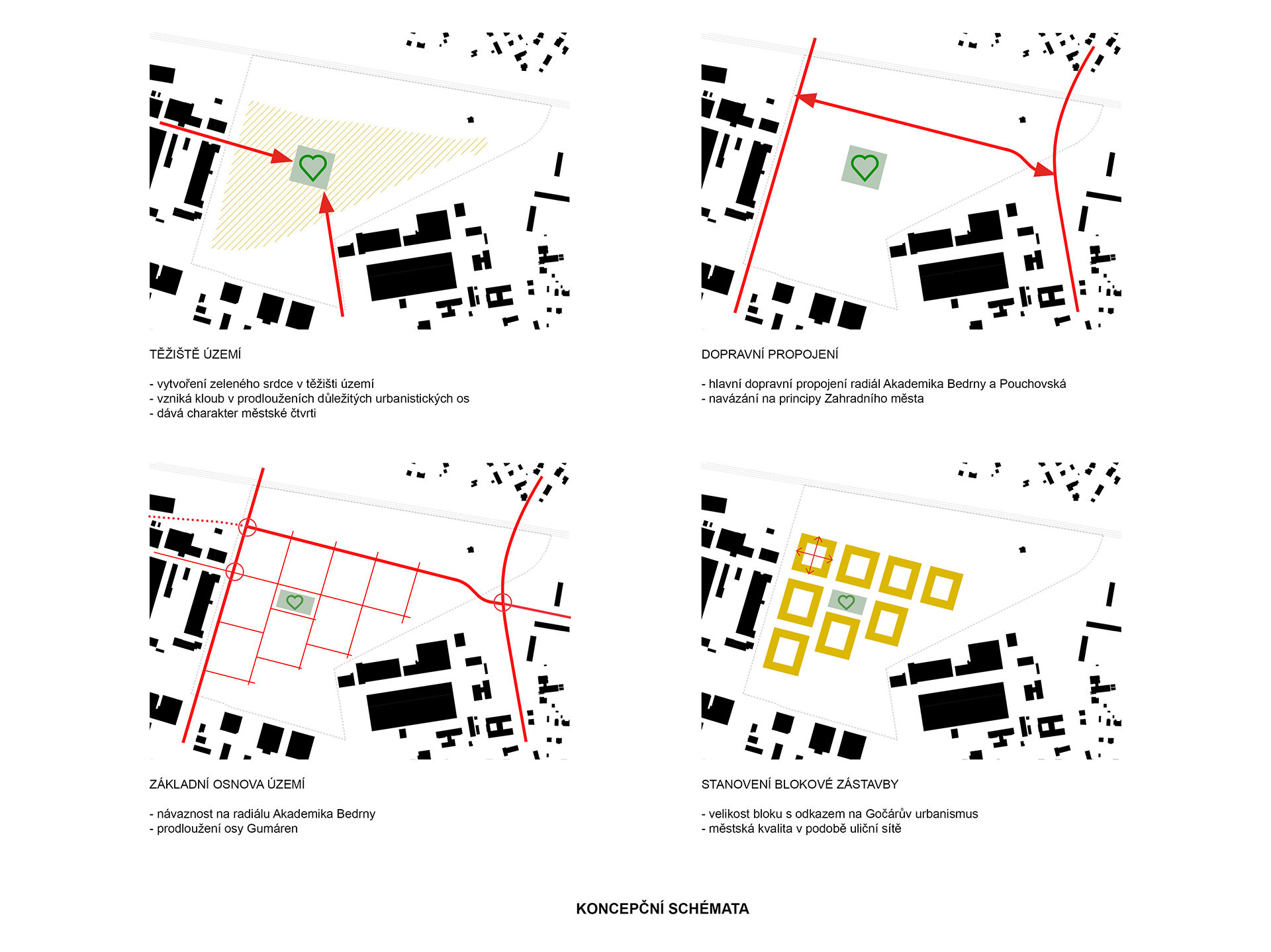
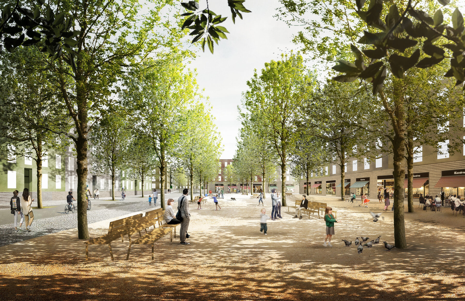
The base objective of the proposal is not to create a mere developed city area, but a city district. In order to achieve this goal it is necessary to first create a polis, i.e. a clear and comprehensible structure and hierarchy of urban areas and forms. This is facilitated by dealing with public areas and determination of their nature and quality. The residential quality of the environment depends on it.
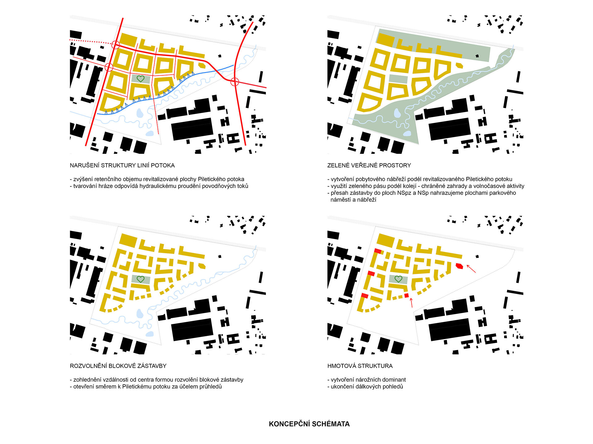
Structure of built – up area, street grid
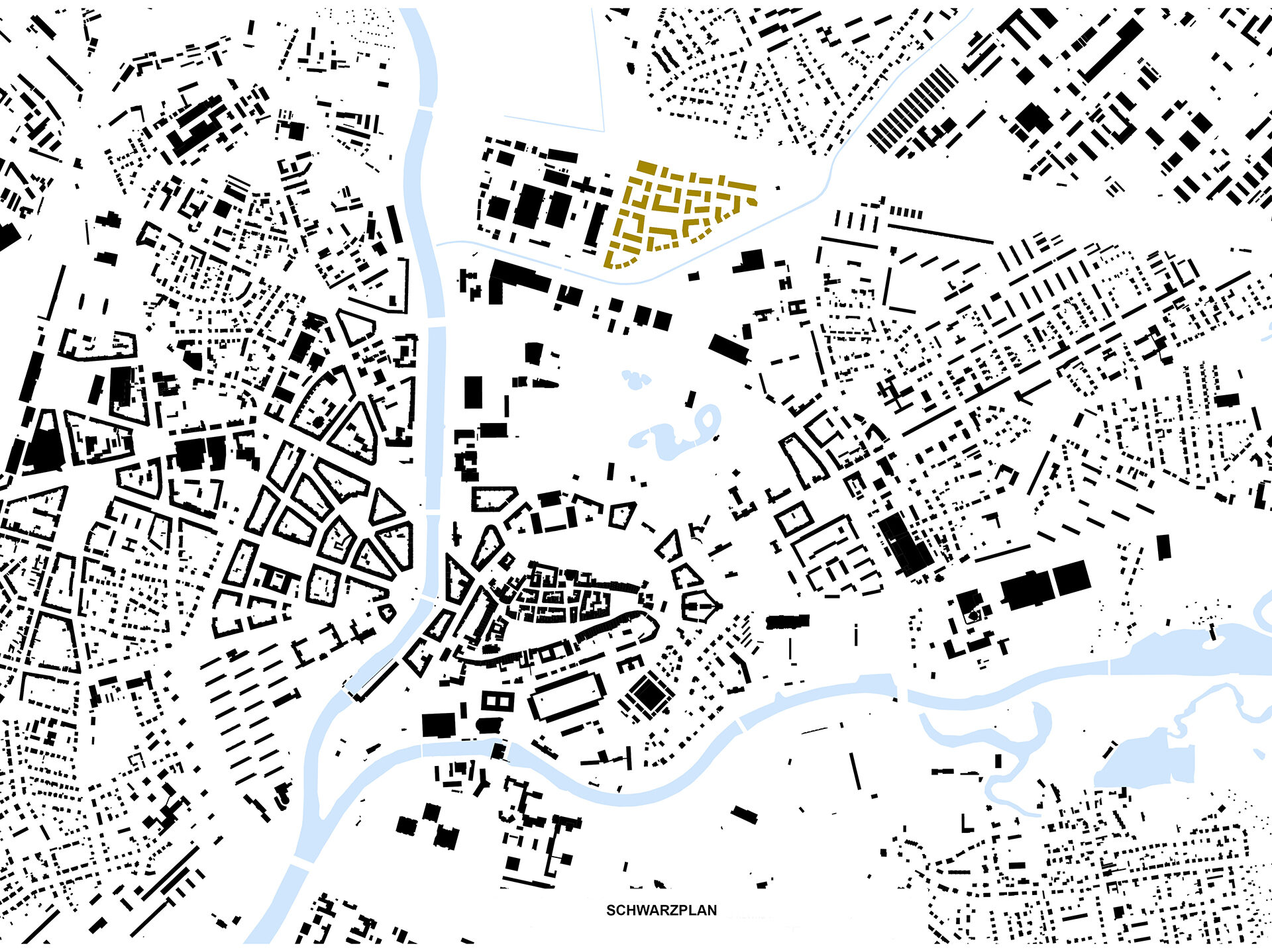
The center, being the heart of the district, is a park square located in its focal point. The structure of the built-up area is sectioned into blocks defined by street grid. The street grid geometry is defined firstly by the scale, i.e. a suitable size of the residential block (in this case ca. 80 x 80 m), and also by orientation or direction, which is defined by its governing line – radial road of Akademik Bedrna. The grid geometry is also defined by possible connection points to the adjacent streets following up on the existing ones on the area border. However, not many existing streets lead into the area circumference. The reason is that the developed area has a triangular shape, sides of which are defined by the railway line from the north and a belt of industrial areas from the west, in combination with shopping centers in the south east. As such, street connection to the surrounding city texture is limited to three options only: in the east by intersection connection through Pouchovská radial road to Severní street and Slezské Předměstí linked thereto. Severní street is to be linked in the west through the Akademik Bedrna radial road to the main communication in the Gumovka premises and furthermore in the north the Akademik Bedrna street leading to Severní street, into the possible future intersection of the newly created street, which will run alongside the original halls, which will be partly preserved. In relation to the design of the neighboring area, the premises of Gumovka Rubena are perceived as an area with large potential, and it is necessary to respond to the future development and re-conversion of this area to a city district as soon as in the course of foundation of the new street grid of the proposed development.
Nature and vegetation
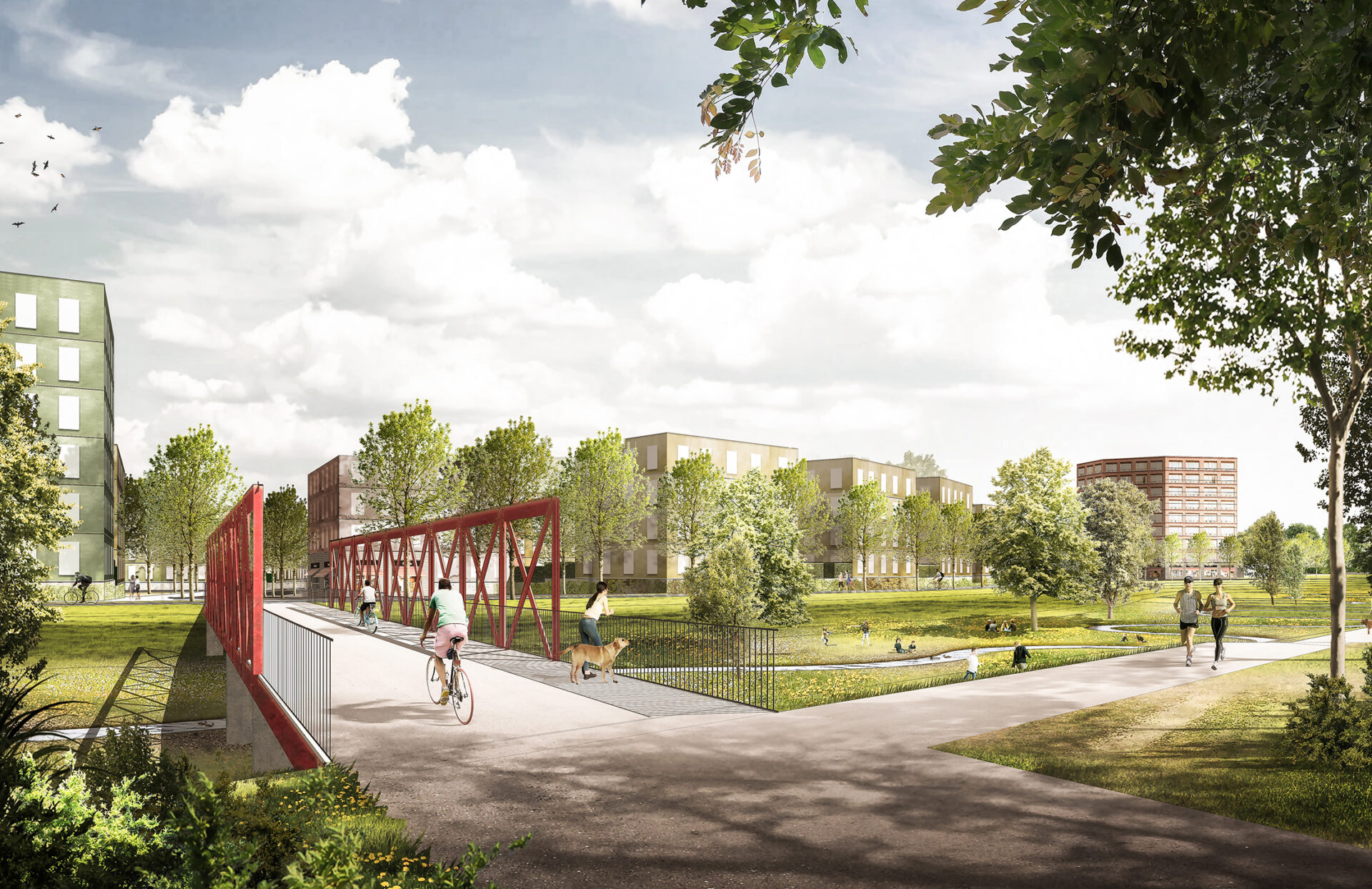
The final geometry of the urban grid as a man-arranged and as such an exact work is, however, substantially influenced by nature. The city nature also has its power and dynamics. These are represented by the water body of Pilotický potok, the basin of which, after modification to a form close to the nature, winds in the creek floodplain, with its retention volume serving as a counter-flood measure. It is the winding water body and the wavy banks of the floodplains from the south east, which affect the urban grid by their “power of nature”. The pressure of nature deforms its ideal geometry, which crumbles and opens up towards the creek floodplain. This at the same time brings exceptionality, specific natural character and quality to the district. The city nature also forms its frame from the opposite, northern side, in the form of the park along Choceňská railway (or more precisely railway leading to Týniště n. O.). To make the line visually overshadowing the railway rampart have its own character and significance for the area, it is designed as background facilities for active lifestyle of residents, i.e. as a complex of open sports fields and children’s playgrounds in a linear park. “Green” is not only the framework of the new district, but also to its center, its heart. Trees from the central park square in the form of street tree lines “fill” the whole urban grid and as such create its vegetation structure, interconnect its public areas with natural parks on its circumference and lay a foundation of the blue-green infrastructure of this portion of the city.
Residential blocks: texture, character, scale, floor area ratio
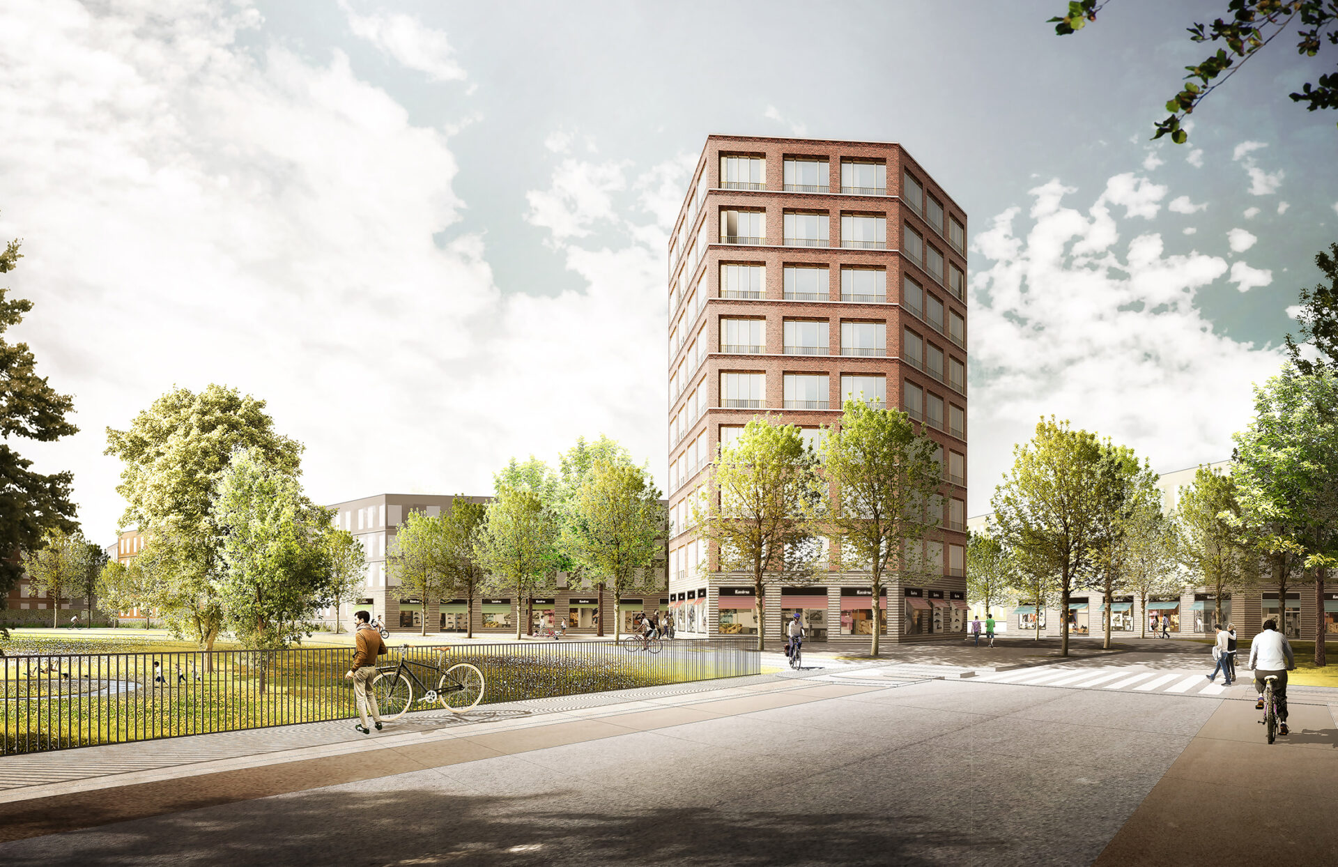
The area being dealt with lies on the outer edge of the Gočár circuit, i.e. the internal city traffic circuit, on the border between the broader center and the village-like suburbs. For this reason the development consists of low-rise, i.e. four-story buildings. An exception is the eastern front of the city radial road of Akademik Bedrna, rhythm of which is governed by the higher corners (5 stories), five-story buildings on both forefields of Svinarský most (Svinar bridge) across Piletický potok, i.e. on the pedestrian and bicycle entrance to the district from the city center and Šimkovy sady. A specific role in the height composition is played by the nine-story building in the south-east vertex of its ground plan triangle. Its significance consists both in its position on the only sharp vertex of the district’s triangle ground plan, and in anchoring of its position it the city silhouette. This also holds true with regard to the building motive being the “gateway” to the new district in the only connection point to the Hradec street network. At the same time its height articulates the transition to the height of the follow-up ten-story concrete block housing estate of Slezské předměstí.
Residential blocks have open corners, which allows for illumination and insolation of apartments in corner positions, as well as better illumination and ventilation of backyards. This is also the way that gave rise to the dynamic rhythmization of street lines, which creates one of the urban motives of the district. On the other hand, the city atmosphere of the main square is jointly formed by its solid, compact corners. The outer line of blocks on the south-east border of the district, which follows by its organic ground plan progression the edge of the creek floodplain, opens up in its direction, and consists of a line of cuboid houses placed next to one another. This makes the creek floodplain penetrate deeper into the district organism, it comes into visual and sensational contact also with backyards and backyard facades of the opposite block lines.
House as basic component unit
The development scale is based on the width of the house face as the base component unit of residential blocks. Each block, each street line consists of individual houses, each of them having its “own” facade (even if only by surface color differentiated from its neighbors). This defines the city rhythm of street space and a scale of the street line, but it also provides a possibility to residents to identify with their homes.