Svratka Riverfront, Brno
2017, open competition
| Team: | Barbara Bartoňková, Jan Kozák, Lenka Ľuptáková, Petr Pelčák, Jan Rolinc, Petr Uhrín, Miroslava Zadražilová, Filip Zlámal |
| Water management: | ŠINDLAR s.r.o., Hradec Králové |
| Cooperation: | Stanislav Brtáň, Petr Damek, Karel Doležel, Jiří Kaplan, Tomáš Kulhavý, Petr Soldán, Martin Sucharda, Miloslav Šindlar, Eva Wagnerová |
| Commissioner: | Statutary City of Brno |
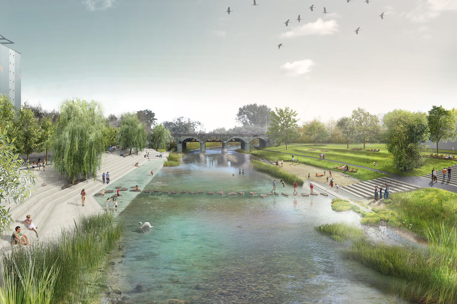
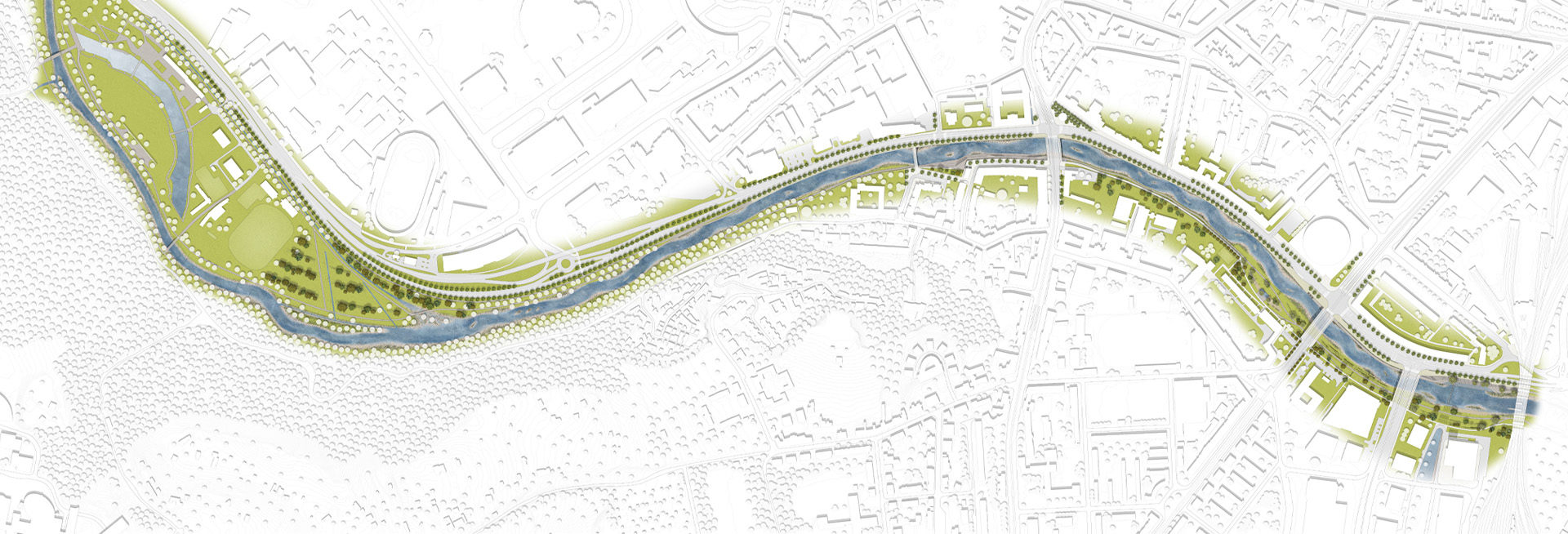
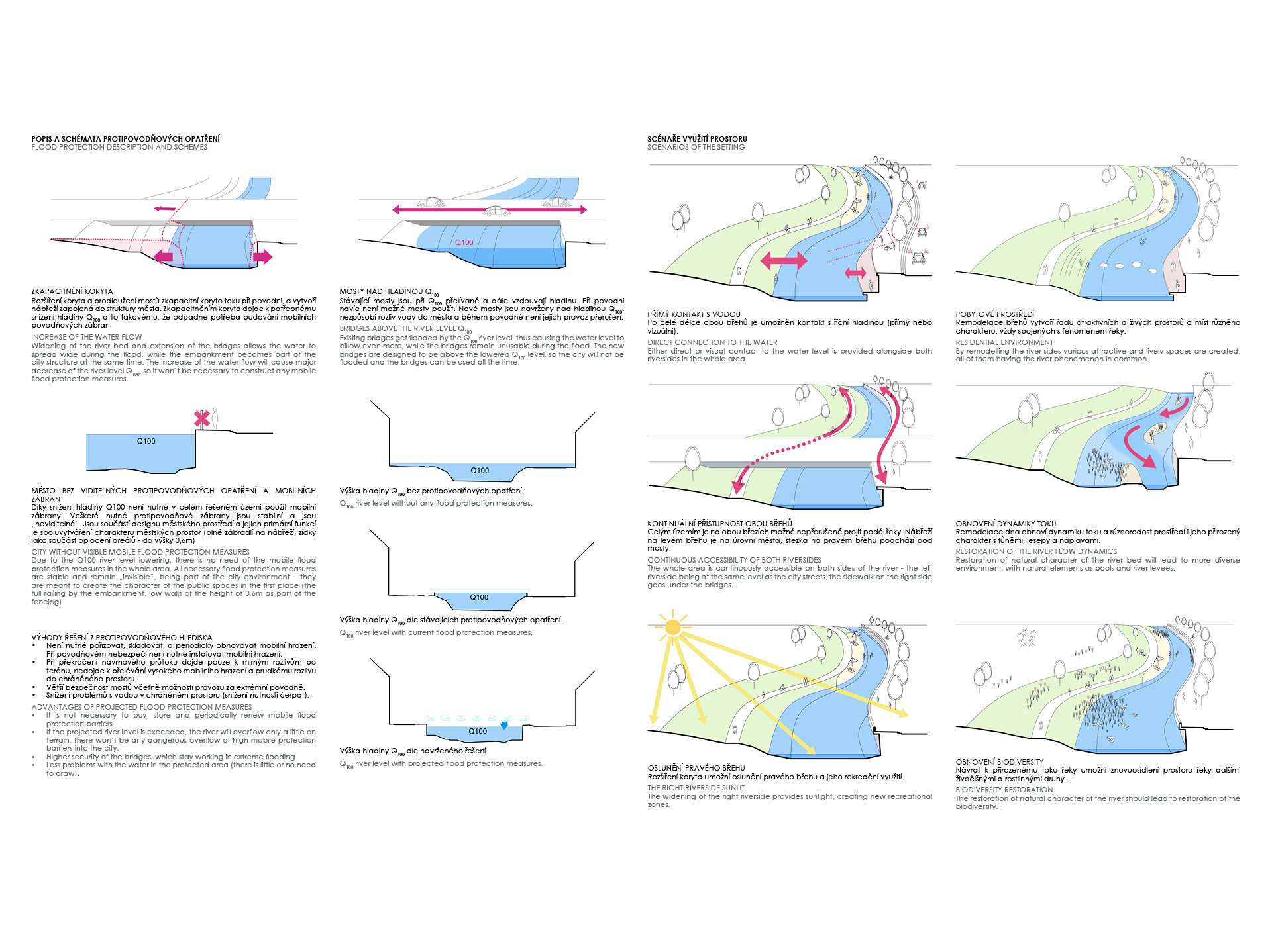
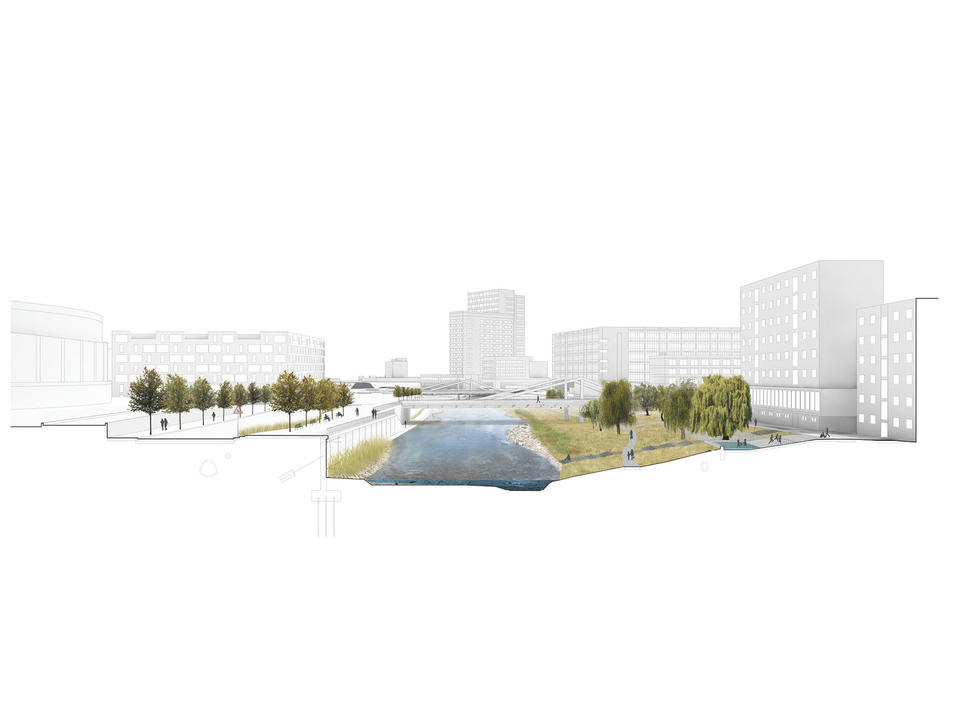
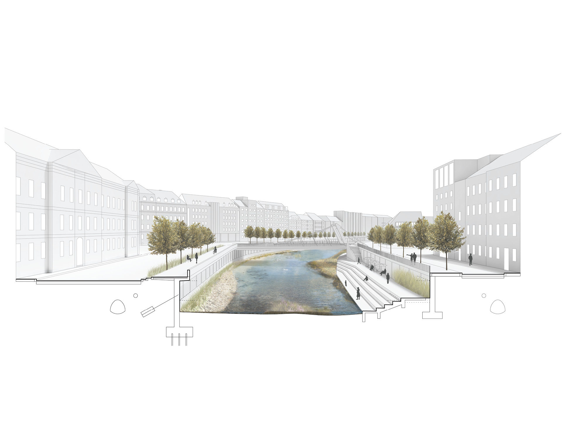
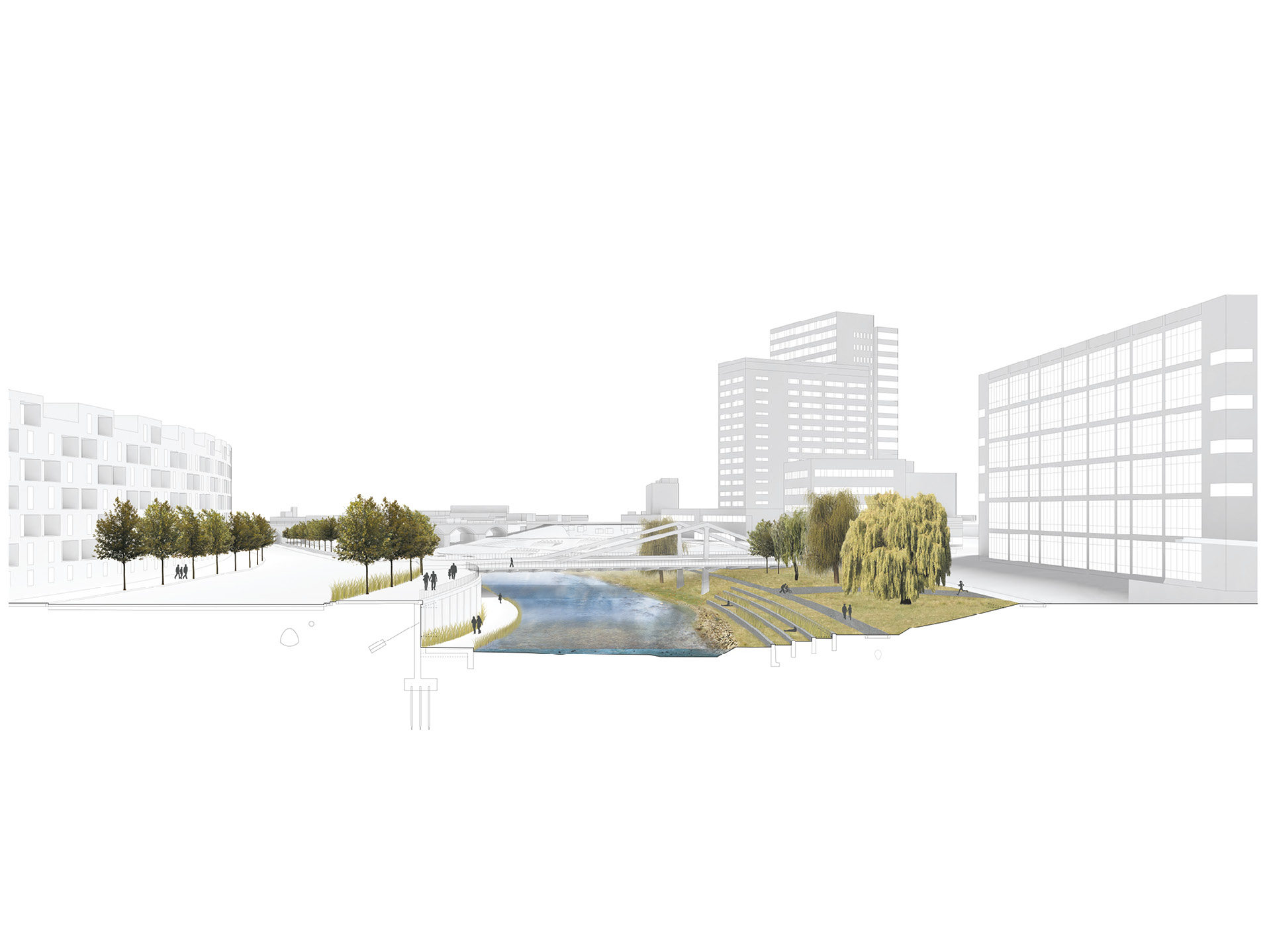
The principal is enlarging the capacity of the riverbed expanding the flow profile without the need for the use of mobile barriers. The widening of the river bed lowers the Q100 water level and eliminates the need for mobile flood protection barriers. The dynamics of the water course, the biodiversity, direct contact with the water and the continuity of the river course through the city are all restored. The areas obtained from the implementation of the flood protection measures are used as public spaces. The right, natural river side, is exposed and opened up to the sunlight, while the left river side becomes an urban promenade. A new, essential quality is given to the city without the trace of any perceivable flood measures.
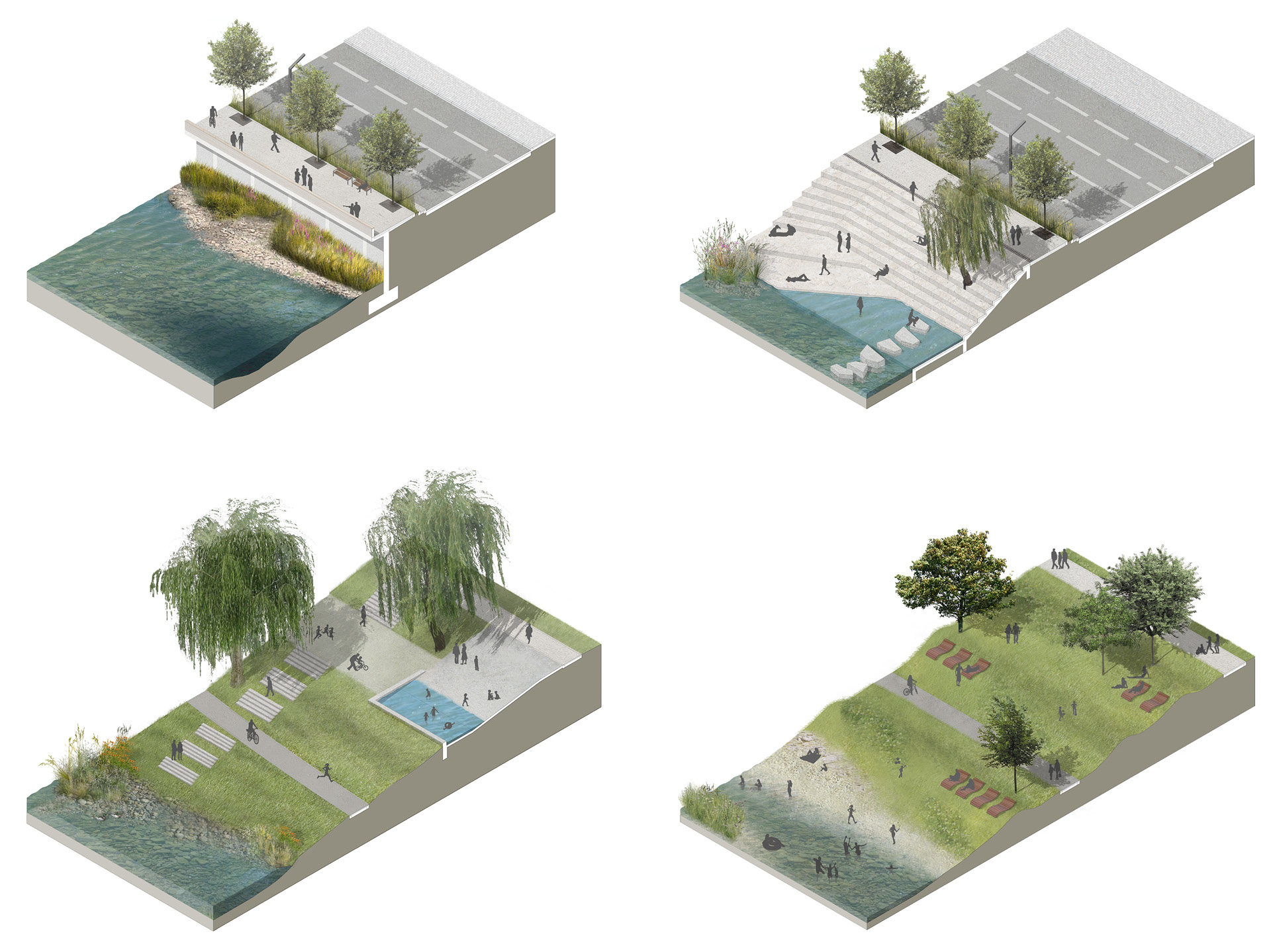
The surrounding nature resembles a winding deepening in a composed profile. The river banks and bottom are shaped in order to create a mosaic of biotopes: flowing fording sections, gentle banks of gravel sediments, deeper pools in the river bends, low placed berms and islands with plant vegetation. The revitalizing also involves the possibility of movement in proximity to the water surface. Regulation of the riverbanks is removed with its stone used for stabilization of the bottom. The riverbed has been widened to a maximum extent, although limited on the left bank by the traffic profile of the street and on the right bank by the width of the open public spaces making possible adaptations to the banks. The right bank is accessible, all along its length, to the water level from the revitalized level, along a sloping terrain to the river or from the stone bathing landing which is designed with steps with its lowest surface on the level of the water surface during normal flow.
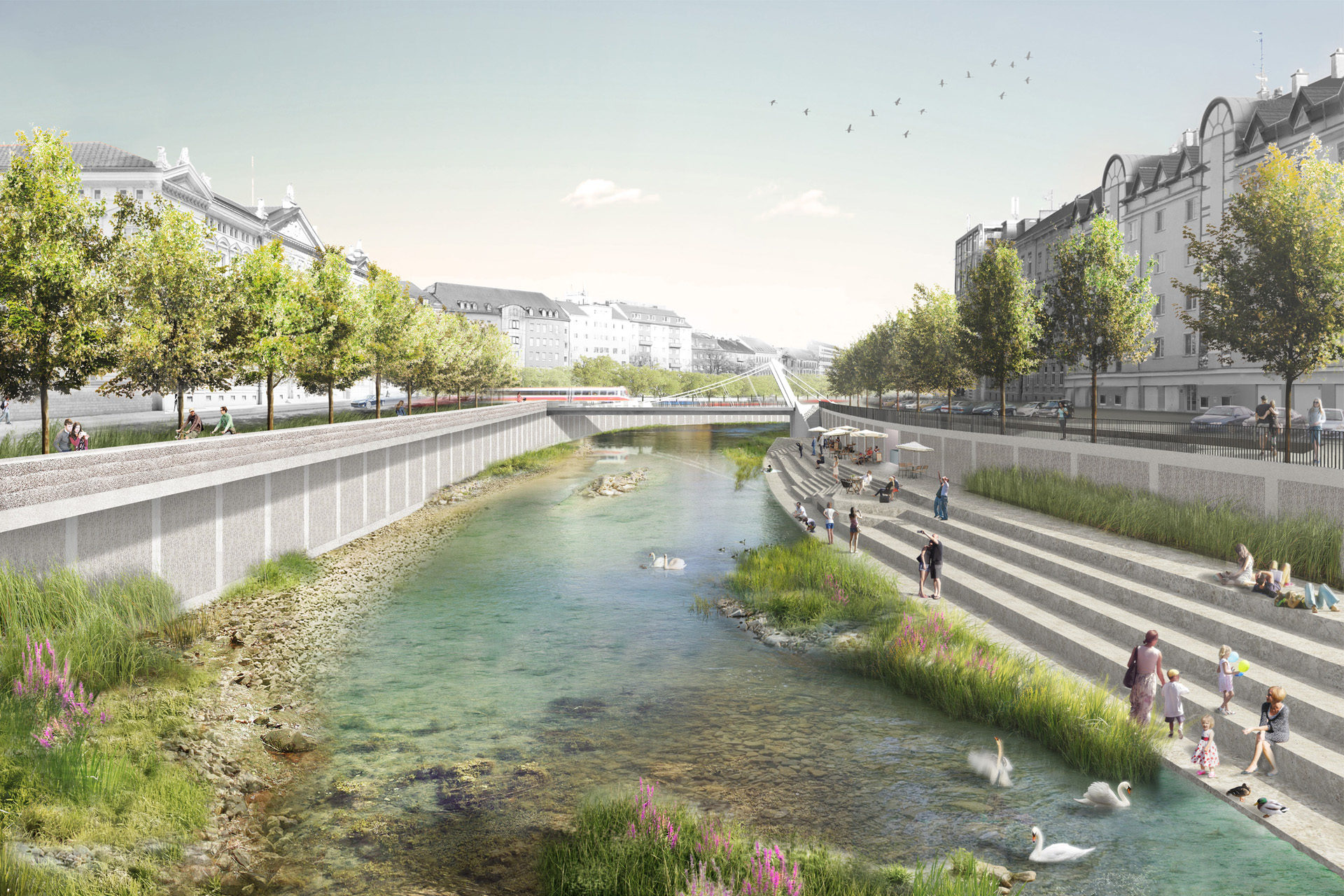
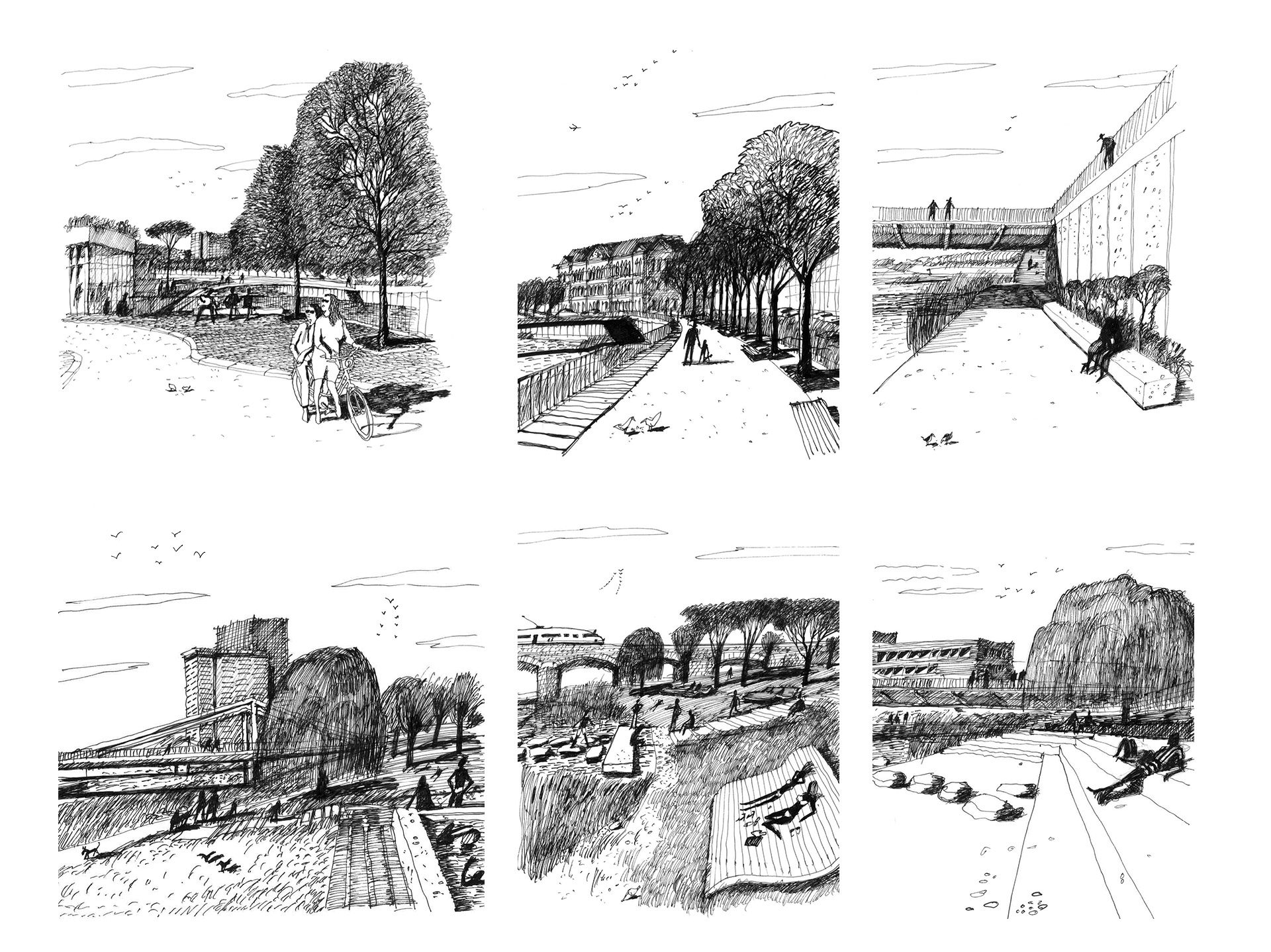
The design provides accessibility for the entire area with both physical and visual contact with the water surface. The left urban bank and the right natural bank provide two distinct looks for the banks. A city promenade is located on the left bank while the right bank has two parallel paths, one paved and unflooded leading along the top of the bank above the Q100 surface and designated specifically for pedestrians and a second with bioasphalt for pedestrians and cyclists at the surface of the usual flow above the level on the one-year water. The already existing bridges have been recast resulting in a rise to the flood level and increasing its flow into the city. The bridges, which are milled every fifteen years, have been newly designed with comfortable pavements. There is space for cyclists to move along under the new bridges.
A bank promenade is located along the entire length of the left bank of a width of 6.5 – 8 metres with a pavement width of 5 – 6.5 metres. It is elevated three or at times two levels above the roadway and separated from it by a belt of high grass and a picturesque row of maple trees in 10 metre segments. They are placed 1.5 metres above the riverbed in the western section with the edges of a natural colouring of layers of tamped concrete fulfilling an anti-flooding function. There are steel railings in the eastern part. They are equipped with benches with a surface from sand-coloured permeable concrete. The bank walls are from reinforced concrete. Their stone surfaces are laid out with 5 metre spacing. Although carried out by means of air tools, they have a character akin to the natural world. The rhythm of the walls continues along the entire banks, weaving in with the placement of the tree lane, the columns, the lighting, etc.
The design creates a natural unit with simplicity being the essential quality. It will also be a strong locale with corresponding natural positions. The collection of strong points and an environment of clear characteristics and specific atmospheres serve to create a certain unification, forming a simple unit.
Advantages of the design:
There is no need to employ, store and renew, on an ongoing basis, mobile barriers
There is no need to install mobile barriers at times of danger of flooding
If and when the designed course is exceeded, only minor overflow of the terrain will occur without flooding over high mobile barriers and rapid flooding of protected areas
Increased safety for the bridges including preservation of operations during extreme flooding
Decreased problems with water in the protected space without the need to pump it across the barriers