Urban-Traffic Study of the X43 Corridor and its Surroundings, Brno
2020
In association with HBH Projekt spol. s.r.o.
| Team: | Petr Damek, Daniel Duda, Lukáš Grmela, Vlastimil Horák, Otakar Hornoch, Radovan Hrnčíř, Manar Chaker, Miroslav Juren, Tomáš Kulhavý, Karolína Langnerová, David Miffek, Filip Musálek, Petr Pelčák, Drahomír Skalník, Petr Skříčka, Filip Stejskal, Jitka Suchomelová |
| Vizualization: | HBH Projekt spol. s.r.o. / Pelčák a partner architekti |
| Model: | ADC Studio group s.r.o. |
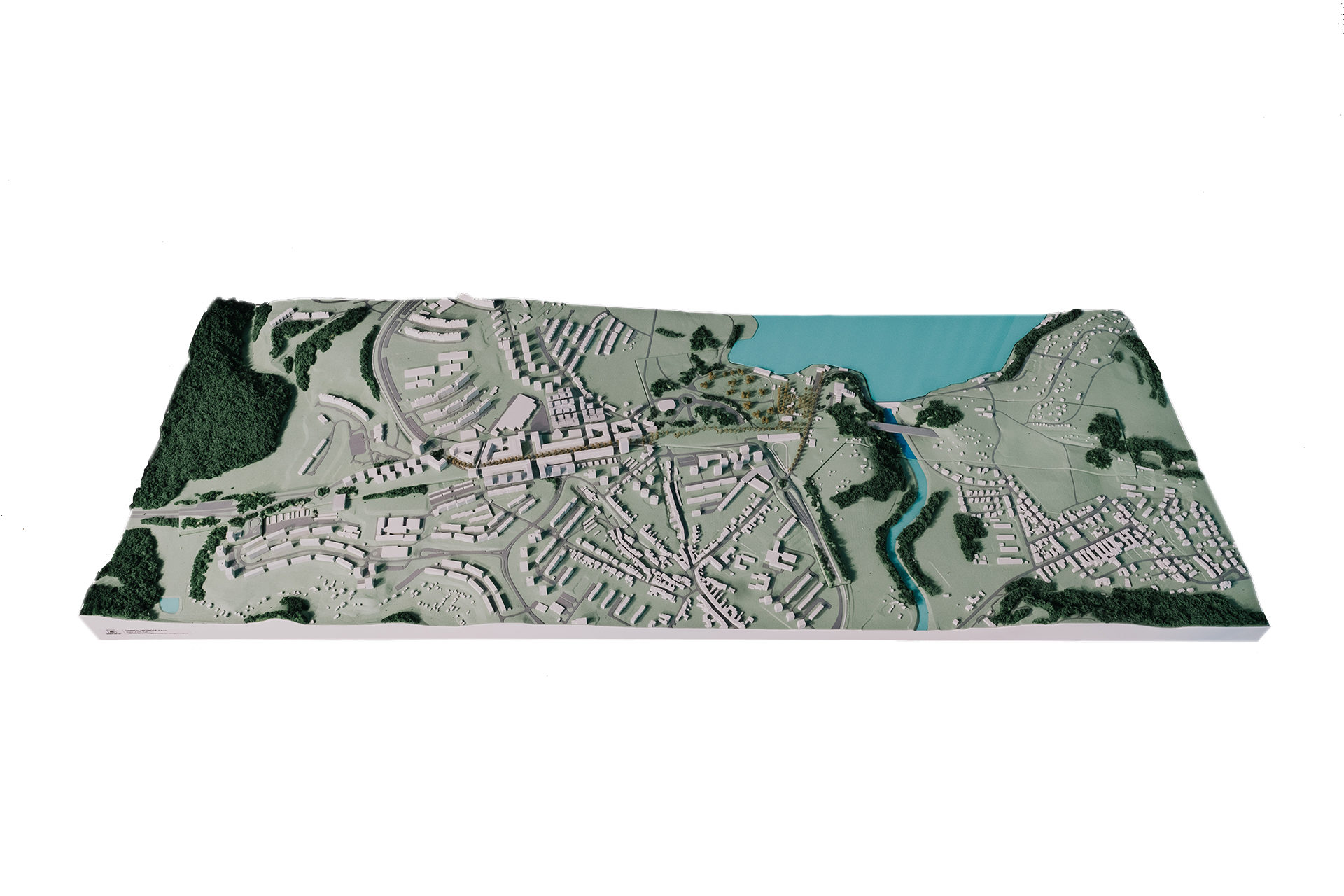
| Photograph of the model: | archiv KAM – Marieta Malíková |
| Commissioner: | KAM Brno |
| Valuation: | Nomination Urban project of 2021 |
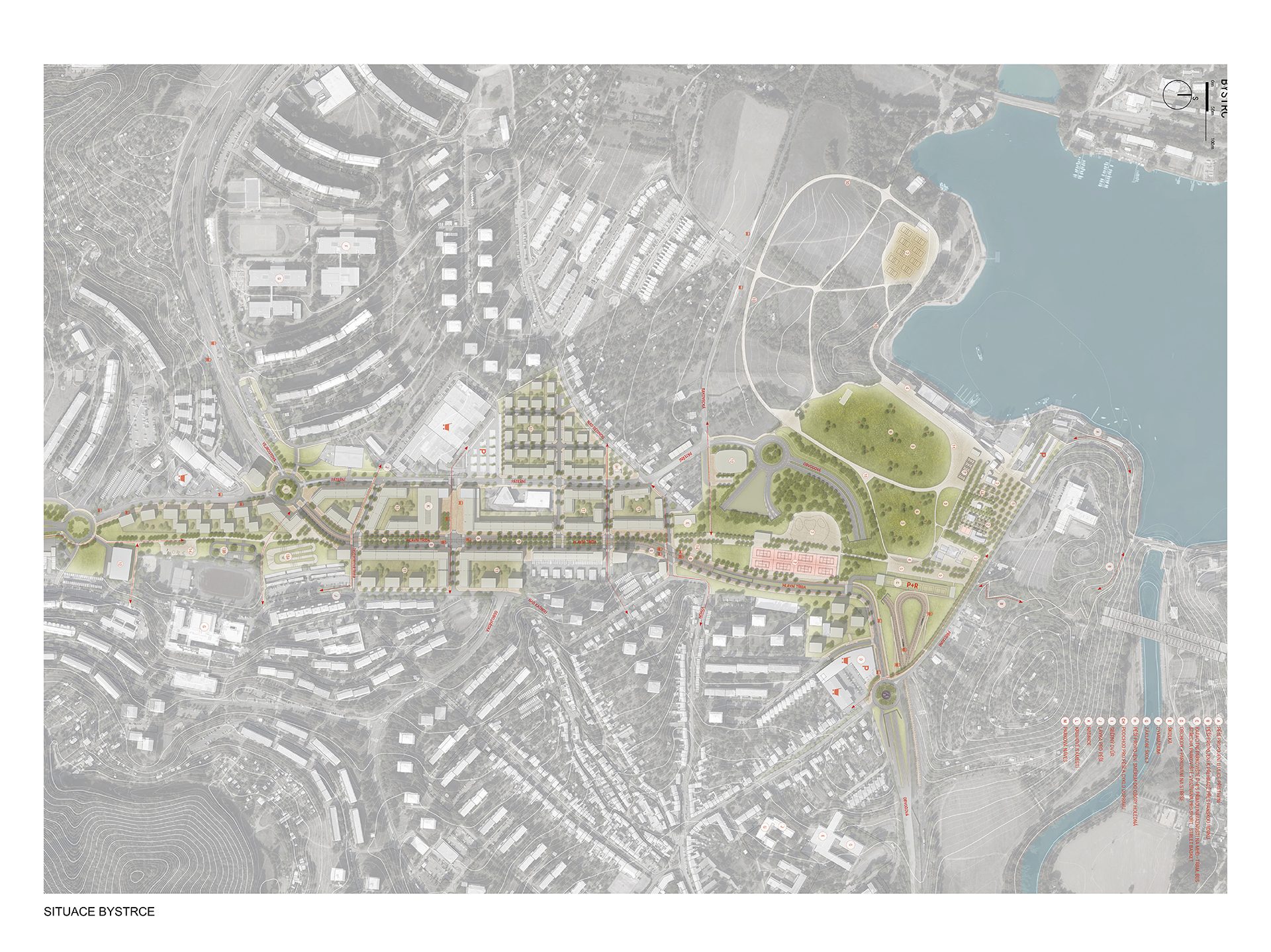
Concept
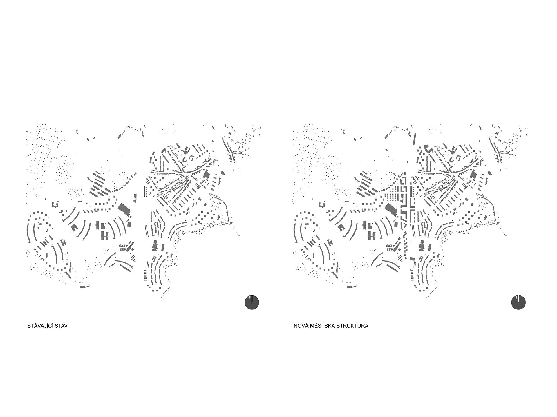
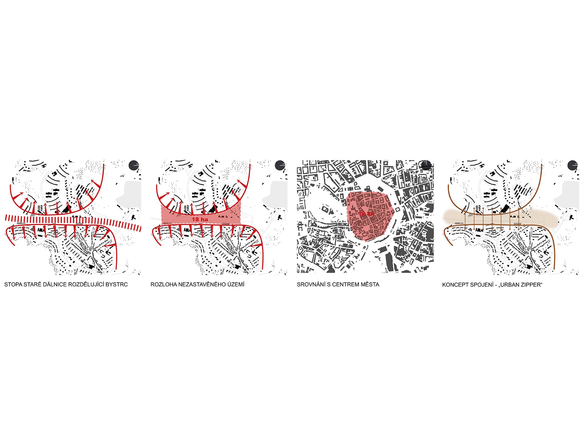
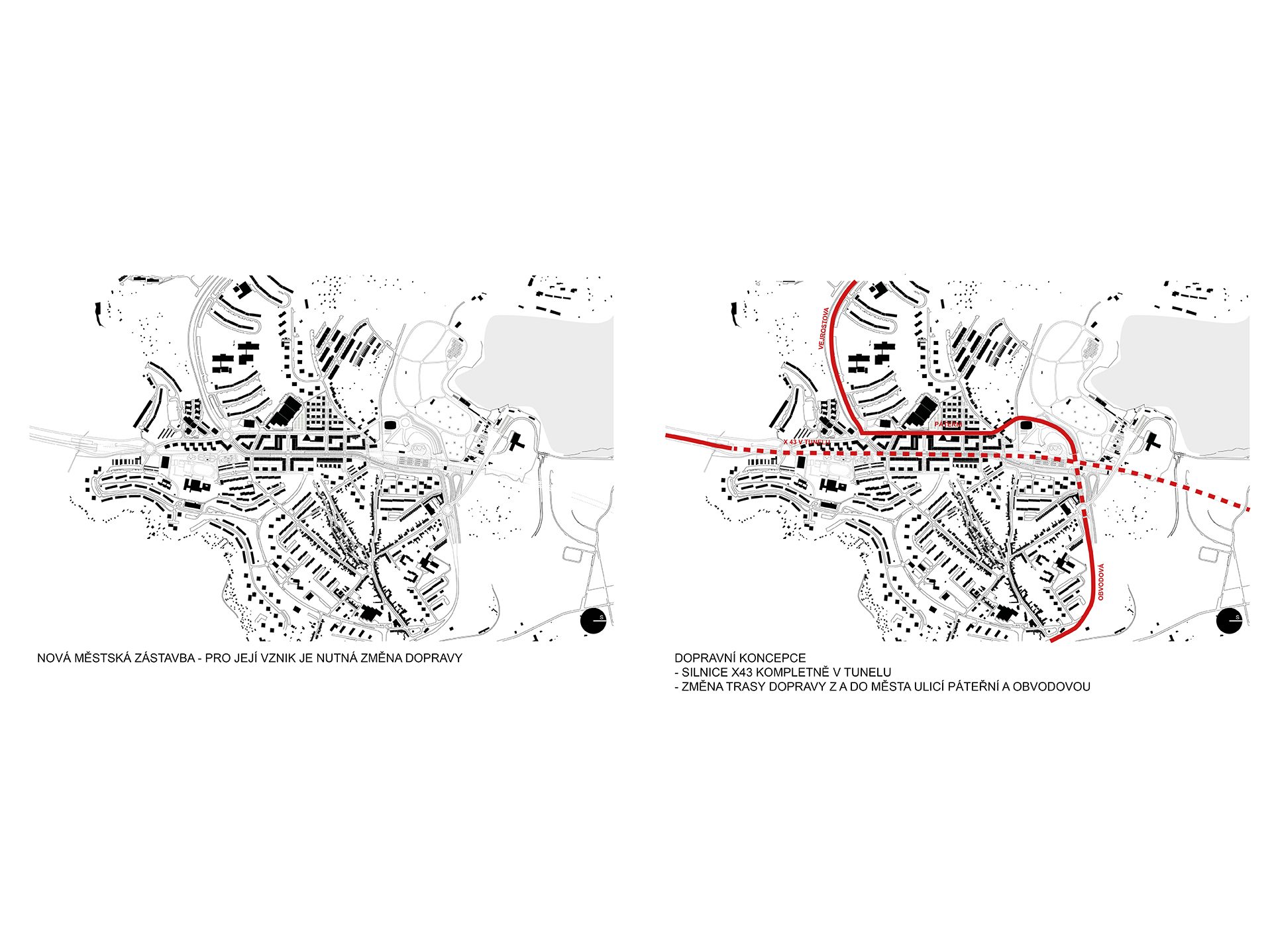
The route of the German motorway and the tram line, which runs parallel to it in a terrain notch in the area of the Bystric housing estate, form a spatial barrier, a strip filled only with traffic structures, the width of which varies between a quarter and a half kilometre. This transport corridor is located deep in the inner city and its area is as large as the historic centre of Brno – about 18 hectares. It cuts the city off from its main recreational facility – Kníničská dam and at the same time divides the district of Bystrc into two parts. Since the state motorway X43, running along the route of the German motorway, will lead underground in the urbanized territory of Brno, that is in a tunnel, it provides the possibility of unifying the divided territory of the city, both parts of the district of Bystrc. These parts which currently have their backs to one another can be united, thereby obtaining land, previously taken up by transport surfaces. This will make it possible to place there a centre for the district which Bystrc currently lacks and also housing which is sorely needed in Brno. Today‘s surface of transport barriers, which divide and complicate the city district, will become a territory which in contrast unifies. The large area of the transport structures will not only be a future construction surface, but also – and this first and foremost – a valuable city space, which can turn these two opposite facing parts of the estate into a genuine city neighbourhood while at the same time providing added value to the adjoining areas. This is all under the assumption that this will be conceived so as to provide the quality which the housing estate currently lacks, whereby both parts of the estate will be focused at the centre and focal point, as opposed to facing opposite one another; all of the transport barriers will also have to be removed. This entails not only the torso of the German motorway X43, but also the notch of the tram line and the transit transportation on Odbojářská street, which complicates and divides the older part of the housing estate in Bystrc 1.
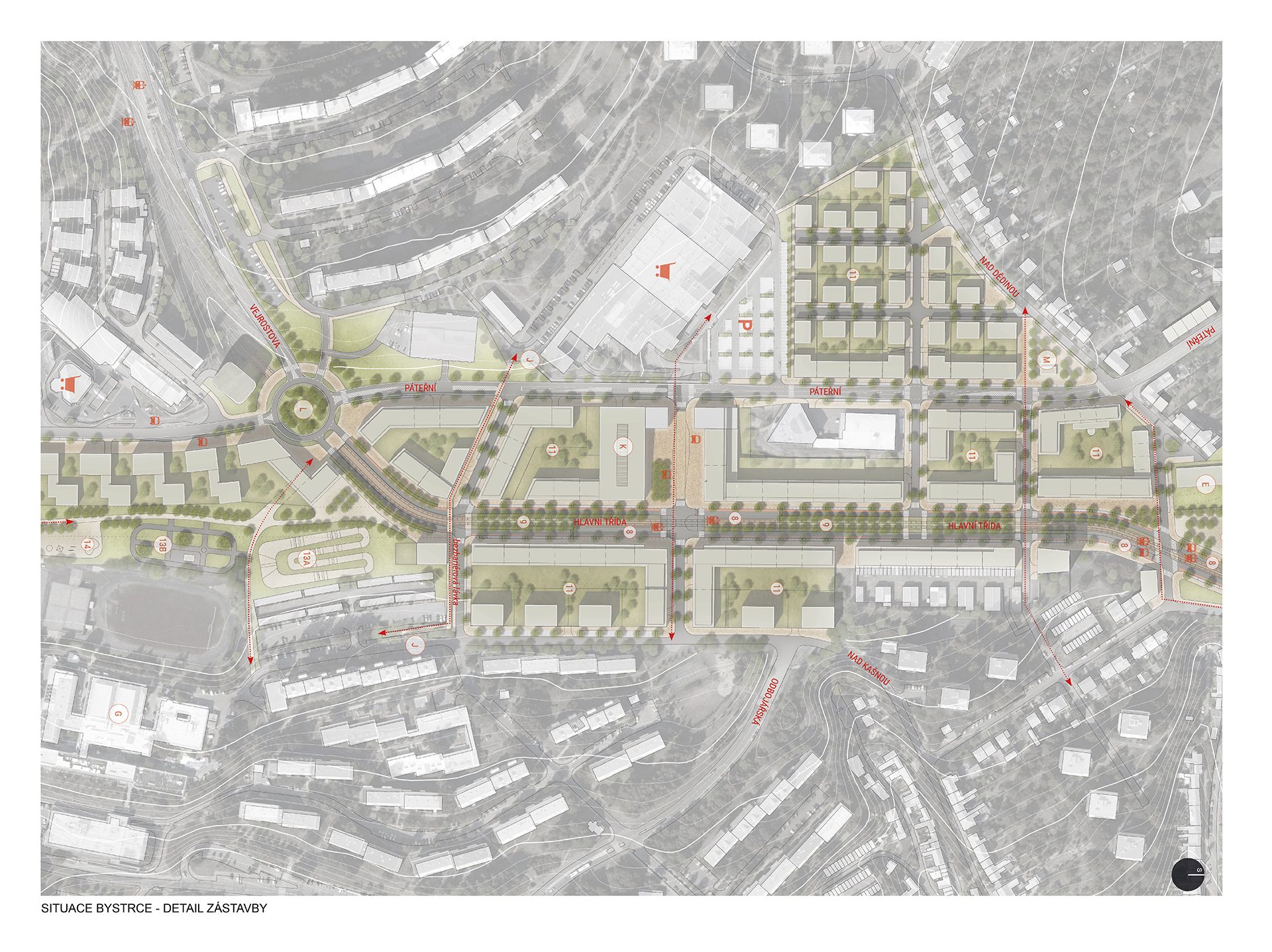
Centre of the district Bystrc – Square and main street
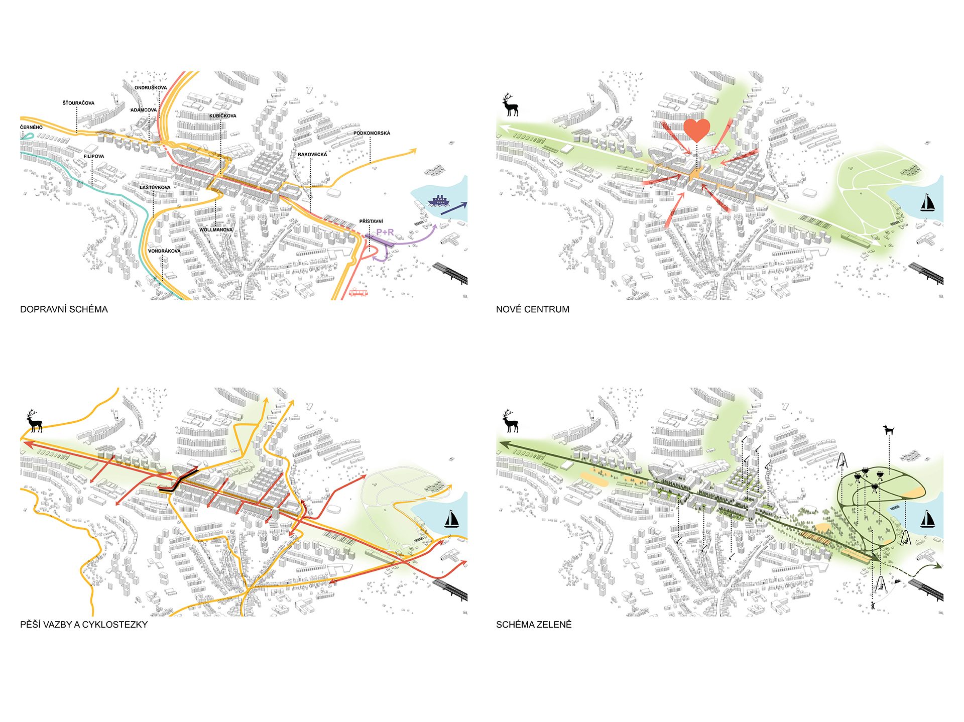
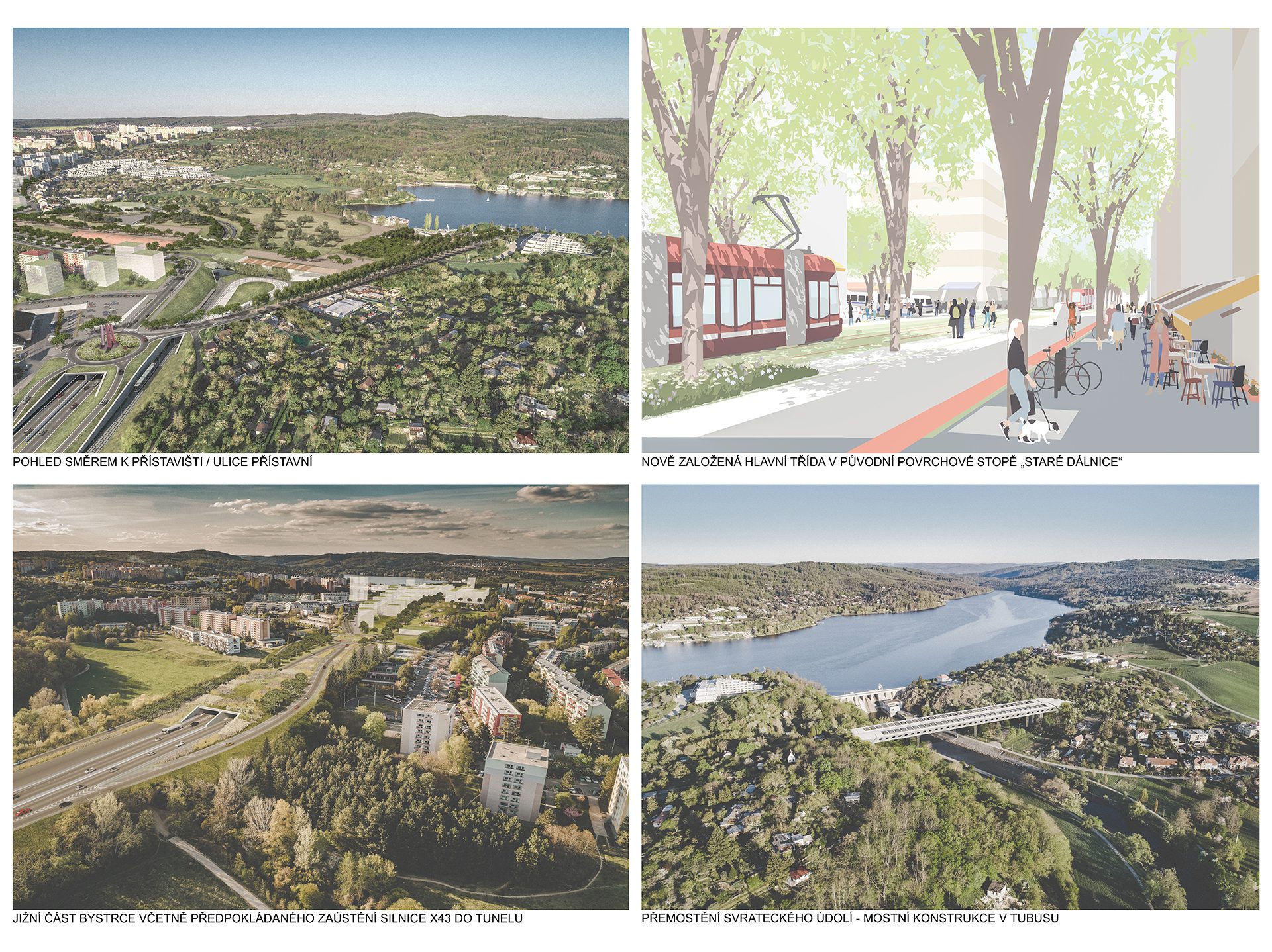
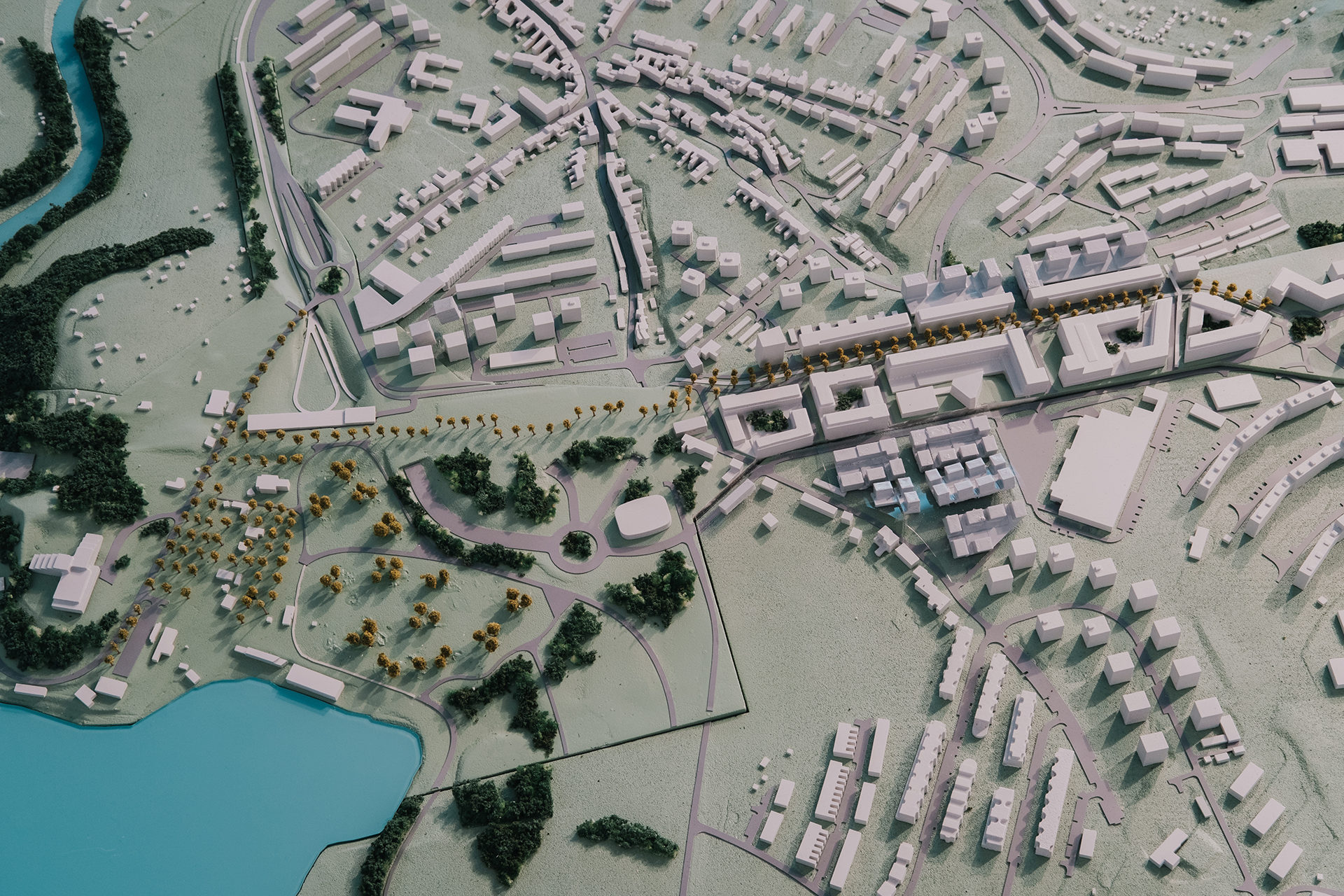
The central idea of making use of the current area of the transport corridor involves its urbanization by means of the structure of buildings, which will connect the Bystrc 1 and Bystrc 2 housing estates. This structure will be compact and form the city centre of the district with a central square (an ideal location for a town hall building) and its main street above the tunnel in the axis of today’s transport corridor. The tram line runs through rows of trees in a central green belt. The tram used in this manner is not a barrier, but a city means of transport par excellence. The main floor of the six-storey (6+1) street fronts (the blocks of flats in the area usually have eight floors) is lively, with shop windows and services. Tram spots of the Viennese type slow down the passage of auto-mobiles and increase the comfort of pedestrians. Auto-mobile transport through the housing estate runs along Páteřní street, which is currently located in an undeveloped area, thus the increase in its traffic load will not impact the existing residential development. Another major advantage is that the transit traffic from Kamechy and from the housing estate in Bystrc 2 to the city and back will no longer serve Odbojářská street, and the housing estate in Bystrc 1 will also not be overwhelmed. On the contrary, Obvodová street will run all along its edge.
The main street with a four row alley is therefore a significant linear element of the green-blue infrastructure, connecting the large proposed sports facilities at both ends and on a larger scale the recreational area of the dam and its quay in the north-west and the Holedna nature area and the so-called Údolí oddechu (Valley of Rest) to the south-east. The belt of new development terminates on both of its sides with a public space: with the round square – with the mouth (Vejrostova street and the connection to X43) with a roundel to the south and a triangular village green on the site linking up with the old village development on Nad dědinou street. The rectangular central square in the centre of the main street culminates opposite the Max shopping centre, with its attractiveness being due not only to the possible construction of the new Bystrc town hall, but also the commercial parterre and the placement of the tram and bus stops.
Quay
The capacity P+R car park is situated in the immediate vicinity of the quay, between Páteřní, Obvodová and Přístavní streets, serving on weekends as parking for the recreational territory of the dam. Přístavní street expands from Obvodová street into a wide pedestrian promenade under the crowns of trees and lined by a range of restaurants. This is followed by a sports grounds with a sports hall on the extended main street in the axis of the former motorway and further by the sports and recreation park on the surface under Rakovecká between Přístavní street and Rakovec with an inline track, outdoor playgrounds and a recreational meadow on the site of today’s field sloping down to the bank with views of the water surface. The meadow is equipped with a number of barbecue areas to enhance the attractiveness of the locale. This provides articulated and direct access to the quay from all of the urbanized surfaces.